Warning: Creating default object from empty value in /home/sites/30b/a/a8be13db6d/public_html/wp-content/plugins/zanmb/reduxframework/ReduxCore/inc/class.redux_filesystem.php on line 29

Warning: Cannot modify header information - headers already sent by (output started at /home/sites/30b/a/a8be13db6d/public_html/wp-content/plugins/zanmb/reduxframework/ReduxCore/inc/class.redux_filesystem.php:29) in /usr/share/php/wp-stack-cache.php on line 1971

Warning: Cannot modify header information - headers already sent by (output started at /home/sites/30b/a/a8be13db6d/public_html/wp-content/plugins/zanmb/reduxframework/ReduxCore/inc/class.redux_filesystem.php:29) in /usr/share/php/wp-stack-cache.php on line 1972

Warning: Cannot modify header information - headers already sent by (output started at /home/sites/30b/a/a8be13db6d/public_html/wp-content/plugins/zanmb/reduxframework/ReduxCore/inc/class.redux_filesystem.php:29) in /usr/share/php/wp-stack-cache.php on line 1973

Warning: Cannot modify header information - headers already sent by (output started at /home/sites/30b/a/a8be13db6d/public_html/wp-content/plugins/zanmb/reduxframework/ReduxCore/inc/class.redux_filesystem.php:29) in /usr/share/php/wp-stack-cache.php on line 1971

Warning: Cannot modify header information - headers already sent by (output started at /home/sites/30b/a/a8be13db6d/public_html/wp-content/plugins/zanmb/reduxframework/ReduxCore/inc/class.redux_filesystem.php:29) in /usr/share/php/wp-stack-cache.php on line 1972

Warning: Cannot modify header information - headers already sent by (output started at /home/sites/30b/a/a8be13db6d/public_html/wp-content/plugins/zanmb/reduxframework/ReduxCore/inc/class.redux_filesystem.php:29) in /usr/share/php/wp-stack-cache.php on line 1973

Warning: Cannot modify header information - headers already sent by (output started at /home/sites/30b/a/a8be13db6d/public_html/wp-content/plugins/zanmb/reduxframework/ReduxCore/inc/class.redux_filesystem.php:29) in /home/sites/30b/a/a8be13db6d/public_html/wp-includes/feed-rss2.php on line 8
Geopark – Easymalc's Wanderings https://www.easymalc.co.uk I’d be unstoppable if only I could get started Tue, 28 Apr 2026 12:59:14 +0000 en-GB hourly 1 https://wordpress.org/?v=7.0.4 https://www.easymalc.co.uk/wp-content/uploads/2019/09/cropped-easy-malc-logo-32x32.jpg Geopark – Easymalc's Wanderings https://www.easymalc.co.uk 32 32 140253175 Kents Cavern and the English Riviera Geopark https://www.easymalc.co.uk/kents-cavern-and-the-english-riviera-geopark/ https://www.easymalc.co.uk/kents-cavern-and-the-english-riviera-geopark/#comments Tue, 28 Apr 2026 12:59:14 +0000 https://www.easymalc.co.uk/?p=8487 Originally posted 2019-10-04 06:40:58.

The post Kents Cavern and the English Riviera Geopark appeared first on Easymalc's Wanderings.

]]>

Kents Cavern and the English Riviera Geopark

People who come to Torbay don’t think of it as somewhere with much history, and it’s true in some respects, but search a bit deeper and you’ll find that the area’s history goes back a long way – about 400 million years in fact – give or take a few million.

Explaining the planet’s history is really best left to the experts, but as one of the geological time periods is named after the county of Devon, I think it’s worth knowing how this occurred and how it all fits into the grand scheme of things.

To put it into some sort of perspective, geologists tell us that the earth was formed some 4,600 million years ago, with the oldest rocks in Britain being about 3,000 million years old (and found in North-Western Scotland). From this we can see that Devon’s beginnings don’t go back quite as far back as they might first appear, so why was the Devonian Period so named?

We only need to go back to the 1830s to find the answer. Up until that point, scientists from the early 18th century onwards were trying to map and categorize different geological time periods, and Roderick Murchison and Adam Sedgwick, two eminent members of the Geographical Society in London, had identified two separate eras which they called the Silurian and Carboniferous Periods.

This neat classification was thrown into some disarray when a colleague, Henry De la Beche, who was categorizing rocks himself in Devon, suggested there was also likely to be an intermediate period: The disagreement between the two parties led to the debate becoming known as the ‘Great Devonian Controversy’.

Paradoxically, it was Murchison who made the discoveries to prove that De la Beche was right all along. This intermediate era was determined to be between 359 and 419 million years ago, and was subsequently called the Devonian Period.

In the chart below, the Devonian Period is half-way down the Paleozoic column coloured brown.

Geological Time-Scale

You’ll be pleased to learn that this isn’t a Geology lesson, not only because I don’t know enough about the subject, but also because I write travel blogs not theses.

With that in mind I’m not going into detail about what rocks there are and how they were formed, but instead I’m going to just give a brief explanation of what there is to see around Torbay for the casual observer.

The first thing that you’ll probably notice is how red the soil is. This is all due to the fact that the crust of the earth has been moving around ever since the planet was born, and at the time these sedimentary sandstone rocks were formed (approximately 250-300 million years ago), Torbay was on the same latitude as the Sahara is today.

Red Sandstone at Maidencombe

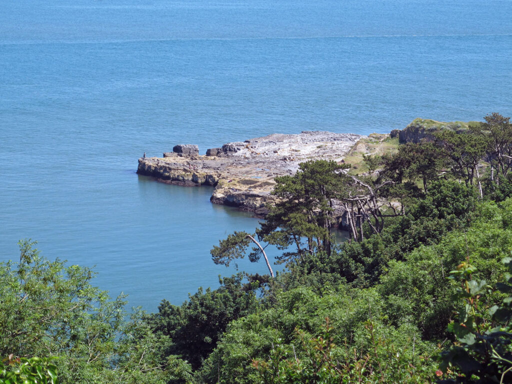
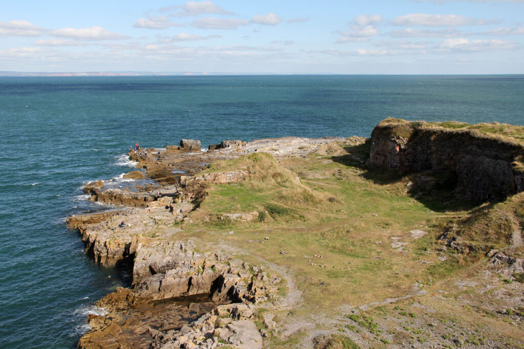
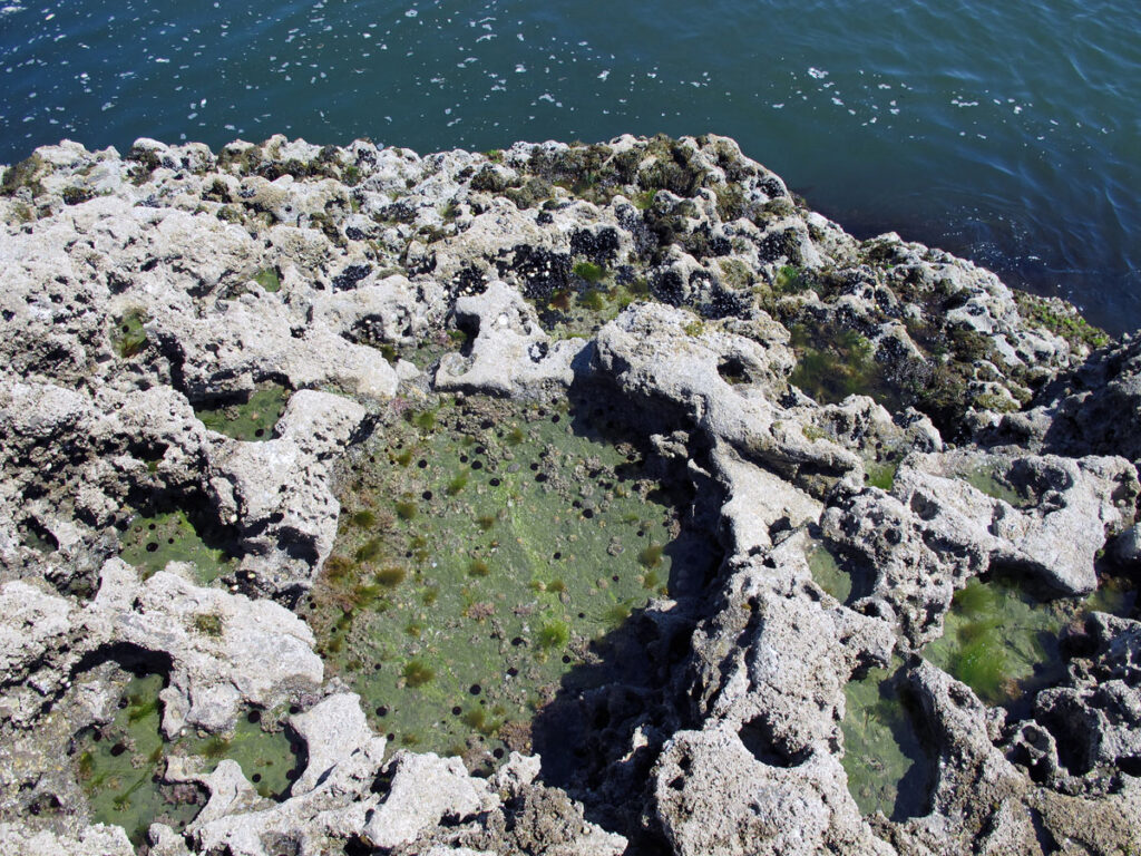
The other most notable features of Torbay’s geology are the limestone headlands which form the arms of the bay at Berry Head and Hope’s Nose. These are amongst the oldest of the bay’s rocks and were formed around 360 million years ago.

Both Berry Head and Hope’s Nose are worth visiting, even if geology isn’t your thing, but the most interesting place to visit if you are, is undoubtedly Kent’s Cavern.

The Old Limestone Quarry at Berry Head
Limestone Rocks at Hope's Nose

Kents Cavern is made from the same Devonian rocks as Berry Head and Hopes Nose, and on a tour of the caves you’ll find out how all those millions of years ago, small organisms took calcium carbonate from the sea water to produce hard shells and bones, which over millions of years were compressed into limestone rock.

The formation of the cavern itself began around 2 million years ago when rainwater permeated its way through cracks in the limestone: The cracks grew into fissures and the fissures grew bigger and bigger until they became large enough to provide shelter for animals such as hyenas, lions, wooly rhinos and Mammoths, and before you enter the cave there’s a bear’s skull on display that has been put at around 420,000 years old.

Of course, it wasn’t just animals that lived in the caves, but also humans, and stone axes have been unearthed here that can be traced back half a million years. The history of man is another branch of science that is best left to people who are far better qualified to speak about it than me, but archaeologists found an object in Kents Cavern that was pretty significant – a human jawbone: It has recently been dated between 41,500 and 44,200 years old which makes it the earliest modern human (Homo Sapiens) fossil found in N.W. Europe. It can be seen in Torquay Museum where many other finds from the caves are kept. I’m a bit annoyed with myself here because I took a picture of it and seemed to have lost it: I don’t think I would make a very good archaeologist somehow!

Kents Cavern

Records show that exploration of the caves go back as far as 1571, and were opened up to the public for the first time back in 1880. These days, they are in the hands of the Powe family, which they have been for five generations, each one of which have been instrumental in exploring and maintaining them ever since.

Apparently, Kents Cavern was originally known as Kant’s Hole, which is derived from an old Celtic word meaning headland, but you might have noticed that I’ve been referring to the attraction as caves, that’s because there’s more than one cavern: Only about a third of the system can be seen by the general public and the tour takes about an hour.

You’re guided through a labyrinth of corridors and caves, which have not only unearthed archeological treasures, but are also a visual treat, with stalactites and stalagmites transforming the rocks into a variety of different colours and shapes, some of which resemble human faces.

The Face
Another Face?

In 2007, in recognition of all these features I’ve been talking about, Torbay was granted the status of UNESCO’s first world urban geopark. That may sound pretty impressive, but I don’t think it would be fair to compare Torbay with other more geologically significant parts of the world – having said that, it’s probably more significant than most people ever realised.

The Rocky Chamber, Kents Cavern

ORIGINAL POST – OCTOBER 2019

LATEST UPDATE – DECEMBER 2020

Originally posted 2019-10-04 06:40:58.

The post Kents Cavern and the English Riviera Geopark appeared first on Easymalc's Wanderings.

]]>
https://www.easymalc.co.uk/kents-cavern-and-the-english-riviera-geopark/feed/ 23 8487
Thatcher Point to Anstey’s Cove https://www.easymalc.co.uk/thatcher-point-to-ansteys-cove/ https://www.easymalc.co.uk/thatcher-point-to-ansteys-cove/#comments Wed, 01 Apr 2026 13:04:03 +0000 https://www.easymalc.co.uk/?p=7032 Originally posted 2019-04-13 17:11:58.

The post Thatcher Point to Anstey’s Cove appeared first on Easymalc's Wanderings.

]]>

Thatcher Point to Anstey's Cove

Between Meadfoot Beach and Babbacombe is one of Torquay’s most exclusive areas. Centred on Thatcher Avenue, the area is known locally as Millionaire’s Row, but you don’t need to be a millionaire to enjoy what is arguably the most interesting part of the Torquay coastline.

This area of Torbay is as good as anywhere to understand why the English Riviera was given status as a UNESCO Global Geopark, one of only seven locations in the UK. Kent’s Cavern is the best place to begin discovering what all this means, and if you want to find out how the area gave its name to the Devonian Period, check out my post, Kent’s Cavern and the English Riviera Geopark.

Devonian Limestone at Hope's Nose

My previous Torquay post was From Torquay Harbour to Meadfoot Beach, and at the far end of Meadfoot Beach turning right into Ilsham Marine Drive will bring you up to Kilmorie, a development of luxury apartments built in the 1960s, described by the company who owns it in a language that only developers and estate agents can, but to most other people it’s an incongruous eyesore. As the road winds up to the top though, it will soon become obvious why people with money would want to buy property here. For us ordinary folk we can at least enjoy a piece of the lifestyle by wandering down the large green open space that leads to Thatcher Point where there are close-up views of the small rocky island known as Thatcher Rock. If you’re into picnics, this is a place to bring one.

Thatcher Point from the sea
Thatcher Point from Ilsham Marine Drive

The island is one of Torquay’s best-known landmarks, and apparently gets its name from the fact that somebody thought one of the outcrops resembled a thatcher working on the roof of a Devon cottage. What is more definite is that the rock is made up of Devonian limestone, 350 million years old, and has a raised beach 25ft above today’s sea level.

Thatcher Rock from above Thatcher Point
A Closer look at Thatcher Rock

Ilsham Marine Drive continues around the coastline, but look out for a path that leads down to Hope’s Nose. A map will show you that the crescent-shaped ‘Tor Bay’ stretches from Berry Head around to Hope’s Nose, but whereas Berry Head is easy to walk out to, the path down to Hope’s Nose is a bit more difficult to negotiate. That said, it’s unlikely that you’ll be on your own when you get down to this Site of Special Scientific Interest (SSSI) because it’s a popular spot with anglers.

Apart from being a good place to catch fish, the limestone pavement is also a good place to find coral fossils, but I must book an appointment with Specsavers as I haven’t come across any yet.

This same limestone also has carbonate veins which when treated with strong acid reveals a web of gold branches. Associated with this gold are two rare minerals – selenium and palladium. Don’t expect to find any gold here now though because collectors have seen to that, but if you really are keen to see what this gold looks like, there are examples in the Natural History Museum in London.

Even if you’re not a person who is interested in geology or fishing, Hope’s Nose is still worth a clamber down to. With views across to the Lead Stone and Ore Stone ahead of you, Thatcher Rock to your right and Anstey’s Cove to the left, it’s worth coming down just for the views alone.

Below are some images taken around Hope’s Nose.

You can pick up the coast path again a bit further along Ilsham Marine Drive. This part of the path is known as the Bishop’s Walk, named after Lord Bishop Henry Philpotts of Exeter who built Bishopstowe, a large mansion, in 1841. In 1921 the mansion was converted into the luxury Palace Hotel, which is now in the process of being demolished in preparation for a new five-star resort spa which should be completed by 2023.

The Bishop’s Walk emerges at the car park above Anstey’s Cove, and even though it means walking down a fairly steep path to reach the cove it’s worth it. Sheltered by Long Quarry Point, Anstey’s Cove is popular with kayakers and those who enjoy coasteering, but it’s usually pretty quiet, and if the little café is open, a good place to end this section of the coast path.

Long Quarry Point, Anstey's Cove
Anstey's Cove
Anstey's Cove

This area of Torquay is a quiet part of town, and whether the Devonian limestone rocks hold any interest to you or not, it’s a part of the bay that is a pleasure to visit for anyone who prefers a few hours away from the hustle and bustle of the harbour – and who knows? If you find any of that gold at Hopes Nose, you might even be able to afford a house up on Thatcher Avenue as well.

Thatcher Point from Meadfoot

ORIGINAL POST – APRIL 2019

LATEST UPDATE – DECEMBER 2020

Originally posted 2019-04-13 17:11:58.

The post Thatcher Point to Anstey’s Cove appeared first on Easymalc's Wanderings.

]]>
https://www.easymalc.co.uk/thatcher-point-to-ansteys-cove/feed/ 15 7032
From Torquay Harbour to Meadfoot Beach https://www.easymalc.co.uk/from-torquay-harbour-to-meadfoot-beach/ https://www.easymalc.co.uk/from-torquay-harbour-to-meadfoot-beach/#comments Wed, 01 Apr 2026 13:04:03 +0000 https://www.easymalc.co.uk/?p=6633 Originally posted 2019-02-20 22:00:41.

The post From Torquay Harbour to Meadfoot Beach appeared first on Easymalc's Wanderings.

]]>

From Torquay Harbour to Meadfoot Beach

Even though Torbay is generally thought of as an urban area next to the sea, it doesn’t mean to say that the South-West Coast Path isn’t worth following around the bay. I would agree that it wouldn’t make sense to follow it all the way around, but there are some lovely stretches of coastline between Torquay and Brixham, and I reckon this one from Torquay Harbour to Meadfoot Beach is one of them.

The footpath between Peaked Tor Cove and Daddyhole Plain is about a mile long and known locally as Rock End Walk, but to make it easier to find I’ve decided to start the walk from the Victoria Parade side of the harbour where it meets Beacon Hill.

As you start to walk up the hill, you’ll see a brown tourist sign that leads down to Beacon Cove. Unlike the red sandstone beaches that this part of Devon is well known for, this is a small rocky limestone bay, which until 1903, was a ladies-only beach and a favourite spot for the young Agatha Christie. Next to it is the now empty ‘hairnet’, which before the Covid-19 pandemic arrived, was the home of seabirds and other marine life that made up Paignton Zoo’s Living Coasts. There’s no access onto the coast path from Beacon Cove, so you’ll need to walk back up onto the road if you venture down here.

Living Coasts and Beacon Cove

From Beacon Hill continue onto Parkhill Road and the Imperial Hotel: The official coast path goes straight past the front entrance to the hotel, after which, if you keep bearing right you should find yourself above Peaked Tor Cove. The uninterrupted view right across the bay towards Berry Head was put to good use by the Home Guard during WWII as a secluded mine watcher’s post, where in the event of a sea-borne attack, mines on the seabed could be detonated from the pill-box that is now used by horse-shoe bats.

Beacon Cove, if you remember, was a ladies-only beach and you might like to know that Peaked Tor Cove was the gentlemen’s equivalent.

The View from above Peaked Tor Cove

The cliffs along this part of the coastline are made up of limestone, some of which were quarried for expanding the town after the railway arrived. As you walk along the path away from Peaked Tor Cove make sure you don’t miss the slight detour which offers a good view down to a natural limestone arch nicknamed London Bridge.

London Bridge from Rock End Walk
London Bridge at Sea Level

The main path from here starts to give some exceptional views of Torbay and although it’s a bit of a climb to reach the limestone plateau of Daddyhole Plain you can always use the excuse that you’re photographing the view and not really taking a rest.

‘Daddy’ is an old Devon name for the Devil, who supposedly lived in a cave at the base of the cliff, hence the name Daddyhole.

From Daddyhole Plain the views also extend towards Thatcher Rock and the Ore stone, but even though this is where the Rock End Walk comes to an end, if you take the car-free lane downhill on the far side of the car park it will take you down to Meadfoot Beach.

The View towards Thatcher Rock from Daddyhole Plain

This shingle beach was formed from Devonian slates and shales and runs from Triangle Point around the bay towards Ilsham Valley.

If you can manage to ignore the luxury, but incongruous Kilmorie apartment block (I can only guess at how planning permission was granted for that), this quiet beach will provide a lovely spot to relax, as well as a safe place for bathing.

Meadfoot Beach
Meadfoot Beach
Triangle Point
Triangle Point

There’s a nice little café near Triangle Point, but if you prefer something a bit more upmarket it’s worth walking back towards the lane you came down from Daddyhole Plain and visit the Osborne Hotel in Hesketh Crescent.

This Regency crescent was built in 1848 for the influential Palk family and is a bit like Bath-by-the-Sea. These days the crescent is all part of the Osborne Hotel and in the summer their Brasserie opens up onto a terrace overlooking the sea where you can enjoy a drink, afternoon tea or something from the barbecue grill in what I consider to be one of the best locations to spend a quiet summer afternoon anywhere in the bay. It may not be as cheap as The Meadfoot Café but I reckon you’d be hard pushed to resist it all the same.

Hesketh Crescent
Hesketh Crescent
The Osborne Terrace
The Osborne Terrace

At the time of writing, bus 64 will get you back to the harbour from Hesketh Crescent if you don’t fancy the walk back.

ORIGINAL POST – FEB 2019

LATEST UPDATE – NOV 2020

Originally posted 2019-02-20 22:00:41.

The post From Torquay Harbour to Meadfoot Beach appeared first on Easymalc's Wanderings.

]]>
https://www.easymalc.co.uk/from-torquay-harbour-to-meadfoot-beach/feed/ 19 6633