Theme from Schindler’s List
The post From Krakow to Auschwitz appeared first on Easymalc's Wanderings.
]]>From Krakow to Auschwitz
With so many places still left to add to Easymalc’s Wanderings, people may wonder why I’ve chosen somewhere to write about that will hardly lift the spirits, and I’ll be the first to admit that I’ve been asking myself the same question – and as yet, with no answer.
My trip to Krakow and Auschwitz took place in late September 2003, and it’s inevitable that this account will make for some uncomfortable reading at times, but it’s my intention to make this blog interesting and educational rather than depressing, but at the same time I have to warn readers that there won’t be much to laugh about either.
Now that I’ve lost the few readers that I do have, I need to explain that a subject like this demands a lot more information than I’m able to give here, and so it’s worth bearing in mind that there are bound to be gaps in the story, and I’m also sorry to say that the photographs are at a lower standard than I would have liked; there are gaps here as well, because there are some things that I won’t photograph out of respect.

To make sense of the places I’ll be talking about, it’s necessary, as you would expect, to put things into historical context from time to time – so here goes.
Krakow is the second largest city in Poland, and although this blog is mainly about events that took place during the Second World War, it has to be said that Krakow has a long and varied history, and without doubt one of the country’s most interesting places to visit.
If I were to go back in time to Poland’s early history it would help make for a better understanding of why things turned out the way they did, but it makes more sense to turn back the clock to the 1930s when Adolf Hitler became leader of Nazi Germany.
He had always blamed the Jews for Germany losing the First World War, but he also had a deep hatred of the Slavs to the east, which included the people of Poland (and Russia).
Russia also had a dislike of Poland, which prior to the outbreak of the Second World War in 1939, covered a much larger area than it does today: With war looming, the Molotov-Ribbentrop Pact on August 23rd effectively meant an unholy non-aggression agreement between Russia and Germany on how to split Poland up once the inevitable happened.
World War II began on September 1st when Germany invaded Poland, and sixteen days later when Russia annexed the eastern half of the country, Poland was no longer an independent nation.
The German occupation masqueraded as a new territory under the jurisdiction of the General Government based at Krakow’s Wawel Castle, but it wasn’t long before the intentions of the new masters became clear.

The city of Krakow itself may have been spared (unlike other Polish towns and cities), but its people weren’t so lucky. At first, the biggest threat to the ‘new order’ were the Polish intelligentsia including the political, cultural and social elite who were arrested and sent to concentration camps such as Sachsenhausen – but that was just the beginning.
The Jews may not have been such a threat, but they had to be dealt with, and Krakow had over 60,000 of them, a quarter of the city’s population – and most of them lived in the district of Kazimierz.
Although the current population is naturally much smaller, Kazimierz as a Jewish neighbourhood still exists, and so I went to see what it looked like today (or at least what it looked like in 2003).

It obviously looks very different from the pre-war years, but it was good to see that the community, albeit a lot smaller, still survives. Based around Szeroka Square, there are still a few synagogues and Jewish businesses that keep the Jewish way of life going, and it was my intention to go back one evening to listen to some Klezmer music that is more often than not on offer at one of the cafes in the square, but unfortunately I never made it.

In ‘Mein Kampf’ Hitler described his vision of ‘Lebensbraum’ (Living Space), where Germany could expand into Central and Eastern Europe: His Generalplan Ost was essentially a plan that would use, expel, or exterminate those that were in the way, and for the Jews of Kazimierz it meant all three.
The Generalgouverneur, Hans Frank, wanted to cleanse the city of all its Jews, and so in March 1941, he established a ghetto across the River Vistula from Kazimierz in the suburb of Podgorze.
To get there I walked across the Most Powstańców Śląskich (Silesian Insurgents Bridge) to Plac Bohaterow which, under the name of Plac Zgody, was the focal point of the ghetto.

To begin with, the square was somewhere that people could escape to from their cramped conditions, but it wasn’t long before it became somewhere to dread.
Beatings, executions, and people being rounded up to be sent to the death camps would have all been witnessed by Tadeusz Pankiewicz, the proprietor of the Apteka Pod Orlem (Eagle Pharmacy) at the far end of the square.
The pharmacy was the only Polish establishment allowed to operate inside the ghetto, but the owner didn’t only dispense medicines and pills he also provided false documents as well as being involved with other clandestine operations that undoubtedly helped to save many lives. It was a small museum about ghetto life when I was here, and I’m glad to see that it’s still going strong.
Whether the pharmacist was still here when the ghetto was liquidated in March 1943 or not, I don’t know, but it would have been a sickening site if he was. Those still able to work were marched off to the nearby Plaszow forced labour camp, but the old, young children, and sick were either killed where they were standing or sent off to Auschwitz. The square and the surrounding streets were just left strewn with what remained of their belongings.

Before leaving Podgorze there was still one place that I wanted to seek out – the building where Oskar Schindler ran his enamelware factory.
For anyone who is not familiar with the name, he was the subject of a film by Stephen Spielberg called Schindler’s List – and in my view, one of the best films ever made.
Oskar Schindler was a member of the Nazi party who ran a factory not far from the Krakow ghetto, and the film (based on a novel by Thomas Keneally) is a true story of how he saved the lives of around 1200 Jews who worked for him.
I managed to locate the building, but if I hadn’t known what the outside of it looked like, there would have been nothing there to tell me. Today, it’s a museum that recognises Schindler’s contribution to humanity and what life was like for the Jews in Krakow under the Nazis.
Stephen Spielberg’s family had a Jewish background, as did another well-known film producer, Roman Polanski, who was a young boy when he managed to escape from the Krakow ghetto. His parents weren’t so lucky: His father was transferred to Mauthausen concentration camp in Austria and his mother was sent to Auschwitz.

The journey to Oswiecim, where Auschwitz-Birkenau is located, takes about 1½ hours by road from Krakow, but the camp is split into two between Auschwitz I (the original camp) and Birkenau (Auschwitz II), and convenience over cost was the main reason I chose to use a mini bus service to get here.
Nothing quite prepared me for the experience though. The words Arbeit macht frei welcome you through the gates into Auschwitz I, but they wouldn’t have been a welcome sign to those who were transported here. In English the words translate into ‘Work sets you free’ meaning that if a prisoner was able to work and therefore useful, then it was just possible that they could survive a bit longer than those that weren’t.

Inside the gates, blocks were used to house the prisoners that were subjected to the most unimaginable cruelty.
Block 11 was known as the ‘Torture’ block, which literally sent shivers down my spine when I went inside. There were cells with no light, cells where there was only enough room to stand, starvation cells where prisoners were left without food and water until they died, and even a cell (No 27) which was where the first tests using Zyclon-B were conducted. 600 Russian prisoners of war and 200 sick prisoners were the first people to be gassed to death at Auschwitz, but there were many more to come.


Between Blocks 11 and 10 is the ‘Black Wall’ where executions took place. Official Nazi records show that 1,646 prisoners were shot here, but according to the Auschwitz Museum the number was nearer to 20,000.
Block 10 was where medical experiments took place, and outside are two wooden poles where prisoners were hung by their arms tied behind their back.

Blocks 4,5,6 and 7 have been converted into a museum with glass cases that contain objects that belonged to prisoners – suitcases, shoes, spectacles, false limbs and even hair. This isn’t just a few items; this is personal stuff on a massive scale. Nobody could possibly come in here and not be affected by what they see. A glass case full of children’s stuff still haunts me now; baby things like little mittens and dummies – it’s all here.


It’s even possible to walk into one of the gas chambers for an even more sobering experience, if that’s possible – and if you still got the stomach for it, you can go into the crematorium where the trolleys are still here ready to load bodies into the ovens.
The only saving grace is that nearby is the site where the first commandant of the camp, Rudolph Hoss, was hanged on 16th April 1947.


Birkenau, in many ways isn’t as intensive from an intimate point of view as Auschwitz I, but it’s just as poignant, purely because of the scale of it.
The camp was built by the Nazis as an extension to the first camp – and it’s massive. This was where the transports arrived bringing hundreds of thousands of people into the death camp. When they arrived, they were segregated into those who could work, and those who couldn’t, and by and large that meant that men who could work were sent one way, and everyone else was sent the other – the elderly, the sick, women and children.


On their retreat from Auschwitz towards the end of the war, the Nazis tried to destroy as much evidence as possible, but there are a few barracks showing what conditions would have been like for those who had to endure cramped conditions and communal sanitation until they were exterminated (I hate that word) – inhuman isn’t a strong enough word to describe it all is it?

The figures speak for themselves; the best estimates for the number of people who were deported and died at Auschwitz-Birkenau are; –
- Jews (1,095,000 deported to Auschwitz, 960,000 died)
- Non-Jewish Poles (140,000- 150,000 deported, 74,000 died)
- Roma (Gypsies) (23,000 deported, 21,000 died)
- Soviet Prisoners of War (15,000 deported and died)
- Other nationalities (25,000 deported, 10,000- 15,000 died)

I endeavour to make my blogs fairly short, but I make no apologies for the length of this one – in fact it’s nowhere near long enough as far as I’m concerned.
As to the question as to why I decided to write this blog, I still haven’t come up with an answer, in fact, if anything, it has thrown up even more questions.
Reliving the trip hasn’t been easy at times, but I’m glad in a way, that I’ve brought myself to do it. If nothing else, it’s my small contribution to help keep these inhuman activities fresh in our minds to stop them ever happening again. Perhaps I’ve just answered my own question, but I’ve an uneasy feeling that it won’t make a scrap of difference.

Originally posted 2019-10-31 11:12:14.
The post From Krakow to Auschwitz appeared first on Easymalc's Wanderings.
]]>The post The Topography of Terror appeared first on Easymalc's Wanderings.
]]>The Topography of Terror
The Topography of Terror is both an outdoor and indoor museum on the site of the former Nazi headquarters for the Gestapo and SS.
It lies at the intersection of Wilhelmstrasse and Niederkirchnerstrasse, and covers the area once occupied by the Prinz-Albrecht Palais.
The area around Wilhelmstrasse was the main centre for the Nazi administration, and although Hermann Goering’s former Reich Air Ministry building (now German Finance Ministry) still towers over the Topography of Terror, most of these buildings have long gone.

The entrance to the museum is in Niederkirchnerstrasse, formerly Prinz-Albrecht-Strasse, where at No 8 was the School of Industrial Arts and Crafts.
After the seizure of power by the Nazis in 1933, the newly formed Gestapo (Secret Police) took over the building for its headquarters, and a year later Heinrich Himmler’s SS took over the Prinz-Albrecht-Palais around the corner in Wilhelmstrasse.
By 1939, with the help of Reinhard Heydrich, Himmler transformed this former palace of the Hohenzollern family into the main office of the Reich Security (RSHA).

Being both head of the Gestapo and the SS, Himmler’s enthusiasm for his job is well known. If he wasn’t torturing people here, he was planning where he could do it elsewhere, but on 23rd Nov 1944 all his plans started to fall apart when the RAF bombed his headquarters. With the end of the war in sight Himmler was eventually captured and taken to Luneburg where he committed suicide.


The Russians captured Berlin but under the London Protocol of 1944 the site ended up in the American Sector – but only just, because the boundary ran along Prinz-Albrecht-Strasse. The longest stretch of the outer wall still left standing in Berlin still runs along here and has become part of the museum’s outdoor museum space.


By the early 1960s what had been left of the buildings was cleared and left as a wasteland until 1987 when Berlin celebrated its 750th anniversary and re-discovered the site. During excavation work the cellars of the Gestapo headquarters were unearthed and an outdoor museum was created with a roof covering what remained, and illustrated with pictures of events and people of the times.
After lots of deliberation with what to do with this waste land the idea of a permanent museum was suggested, but it took until May 7th 2010 before the suggestion became a reality.
There are three sections to the museum – the outdoor section as mentioned above which runs under the Berlin Wall, the grounds of the entire site with 15 information stations explaining the various points of interest, and an indoor exhibition.
The modern steel and glass construction of the indoor exhibition is in complete contrast to the classical buildings that once stood here. It’s known as the Documentation Centre which explains its function, and the layout inside is light and airy, which I suppose lightens the tone a bit for such a dark subject. Most of the space is used up by boards showing copies of photographs and documents covering the major themes connected with the site and beyond. This is where I took the old black and white pictures of how the site used to be. The pictures taken in 2003 were from my first visit.


Entry to the whole museum is free, very central and should be a ‘must see’ on everyone’s visit to Berlin.
If the people of Berlin think that this place should be remembered, then I think we all should too.

Originally posted 2019-02-03 06:29:43.
The post The Topography of Terror appeared first on Easymalc's Wanderings.
]]>The post Wilhelmstrasse appeared first on Easymalc's Wanderings.
]]>Wilhelmstrasse - The Former Heart of Nazi Germany
If the outcome of WWII had been different, and London had been beaten into submission instead of Berlin, then imagine if you can, what Whitehall would look like now: Wilhelmstrasse is (or was) Berlin’s ‘Whitehall’.
The road runs for one and a half miles between the Marschallbrucke on the River Spree down to Hallesches Tor in Kreuzberg, but the most interesting part from a historical point of view, is the section between the bridge and Niederkirchnerstrasse where the Berlin Wall split the city into two.
Originating from the time of King Frederick William I, this once wealthy residential thoroughfare, developed into Prussia’s main government district with many of the buildings being taken over by the state, including the Palais Schulenburg for Otto von Bismarck’s Chancellery.
At the end of WWI, the area came under the control of the Weimar Republic, but on 30th January 1933 there was a new Chancellor – Adolf Hitler, who immediately set about building a new chancellery for the Third Reich at the junction of Wilhelmstrasse and Voss Strasse.
After Hitler’s suicide in the Chancellery bunker and the subsequent defeat of Nazi Germany in 1945, the street found itself within the Russian sector as far as Prinz Albrecht Strasse (now Niederkirchnerstrasse). Bomb damage and the Battle for Berlin had left the area in tatters, and as neither the Russians nor East Germans had any reason to save whatever was left, the land where Prussian palaces once stood, was now either part of No-Man’s Land separating East and West Berlin or built upon with Eastern Bloc architecture.

The first time I came here I tried to piece together how it would have looked before the bombs and bullets were unleashed, and apart from one or two exceptions it wasn’t easy, but it’s a bit different now because information boards have been erected at locations of interest.
If you have the same mindset as me, and want to know something about where Hitler and his henchmen planned the Thousand Year Reich, then take a wander down Wilhelmstrasse with me and find out more.
The first place to visit for anyone half-interested in the politics of Germany is the Reichstag which I’ve covered separately, and so I’m starting this walk at the nearby Marschallbrucke end of the street.
Many of the buildings around the bridge are part of the Bundestag (Lower House of the German Parliament), and for obvious reasons are mostly modern, but it’s not long before we reach Unter den Linden and the Brandenburg Gate.

The road is closed to traffic as it passes by the British Embassy, which I’m pleased to say is a fine architectural addition to the Berlin landscape (or at least it is to me).
Opposite is a rare survivor from the past. It used to be the Prussian Ministry of Education and now an office building for the German Parliament.


Instead of continuing on down Wilhelmstrasse Turn right at Behrenstrasse and take a look at the Memorial to the Murdered Jews of Europe, part of which lies over the villa that used to belong to Joseph Goebbels, the Nazi’s Reich Minister for Propaganda. The only thing that’s left is his bunker that lies beneath the memorial, which seems fitting somehow.

If we continue to walk along Cora Berliner Strasse and then cross over Hannah Arendt Strasse into Gertrud Kolmar Strasse we come to the site of Hitler’s Bunker in the Ministergarten.
When I first came here quite a number of years ago there was nothing to suggest that this was the location where Hitler committed suicide, but I had done enough research to think that it probably was.
Under the Soviet occupation the bunker was largely destroyed but not completely, and several corridors are said to still exist. Apartments have been built over the top of it with a small playground in the middle, and I remember sitting here alone thinking about what stories this place could tell, when a young mother and her two small children came to the playground. Whether they knew what was underneath their feet I’m not sure, but from what I’ve read Hitler loved children.
During the last days of his life in the bunker he married Eva Braun. It was too late for them to have children of their own and across the other side of the street is the spot where their bodies were reported to have been burned.

After you’ve come to terms with the situation, take a left turn back onto Wilhelmstrasse where the Palais Schulenburg or Bismarck’s Chancellery (whichever you prefer) once stood. Today there’s a steel sculpture here of Georg Elser who attempted to assassinate Hitler in Munich in 1939. How different things might have been if he had succeeded!


Crossing over Leipziger Strasse brings us to what was the largest office building in Europe when it was completed in 1936. It was built for Hermann Goering’s Ministry of Aviation and it still amazes me how a building of this size wasn’t destroyed by the allied air forces when it must have been known what it was used for. I suppose it was just too big to obliterate. Today it’s used by the Federal Ministry of Finance (see main picture).
During the Cold War the street met the Berlin Wall at the junction with today’s Niederkirchnerstrasse and Zimmerstrasse, and although this is as far as I’m going for now, I can’t leave this part of Berlin without mentioning the fact that across the road are what remains of the SS and Gestapo headquarters – and left to wonder what the world might have been like if Whitehall had got to look like Wilhelmstrasse.

Originally posted 2018-11-16 14:29:13.
The post Wilhelmstrasse appeared first on Easymalc's Wanderings.
]]>The post The Tiergarten Soviet War Memorial appeared first on Easymalc's Wanderings.
]]>The Tiergarten Soviet War Memorial
There are three Soviet War Memorials in Berlin, one in Treptower Park, another in Pankow, and this one in the Tiergarten, which is probably the most well-known of the three, and unveiled just two months after the fall of Berlin to the Soviet army in May 1945.
The Battle for Berlin cost 80,000 Soviet lives and over 2,000 of them are buried here at this large memorial not far from the Brandenburg Gate. Ironically, after the partition of the city into 4 zones, the monument fell inside the British sector.
All parties agreed to allow it to be guarded by two Soviet soldiers, which it did until 1993.

Built of marble (some say from the ruins of Hitler’s Reich Chancellery), it is topped by a bronze soldier and guarded by two Howitzer guns and two T34 tanks. Under the soldier is a Cyrillic inscription which translates as “Eternal glory to heroes who fell in battle with the German fascist invaders for the freedom and independence of the Soviet Union”.


The memorial has plenty of Russian visitors and each VE Day (Victory in Europe – 8th May) wreaths are laid to commemorate the occasion. It has to be said though that it’s not universally popular with the German population and has even been referred to as the “Tomb of the Unknown Rapist”.

Originally posted 2018-08-03 12:58:48.
The post The Tiergarten Soviet War Memorial appeared first on Easymalc's Wanderings.
]]>The post The Siegessaule appeared first on Easymalc's Wanderings.
]]>The Siegesaulle
In the middle of The Tiergarten at Grosser Stern, stands the Siegessaule, or Victory Column, and if you’ve got €3 – and the energy – it’s possible to climb the 285 steps to the viewing gallery that sits just under Victoria, the Roman goddess of Victory.
The monument was designed by Johann Heinrich Strack, and the 8.3m golden statue on top of the column was added by Friedrich Drake and represents both the Goddess of Victory and Borussia, the Latin name for Prussia. Her face is supposedly based on Drake’s daughter and known as the Goldelse (Golden Else), or roughly translated as ‘Golden Lizzie’.
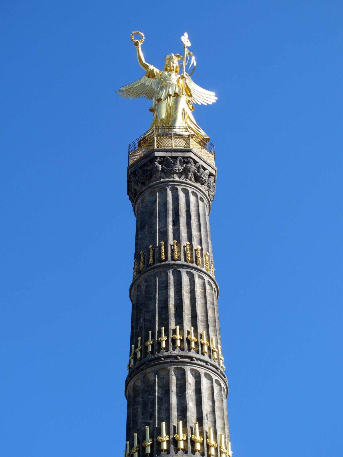

Golden Lizzie must have witnessed some of Berlin’s most historical events over the years. The column was originally conceived to commemorate the 1864 Prussian victory over Denmark, but by the time it was finished, it symbolised much more. When Emperor Wilhelm I unveiled it on 2nd Sept 1873 there had been another two wars and the German Empire had been born.
It was initially located in front of the Reichstag in Konigsplatz (Platz der Republik today) but was re-positioned in 1938 to fit in with the Nazi’s vision of Albert Speer’s ‘Germania’.
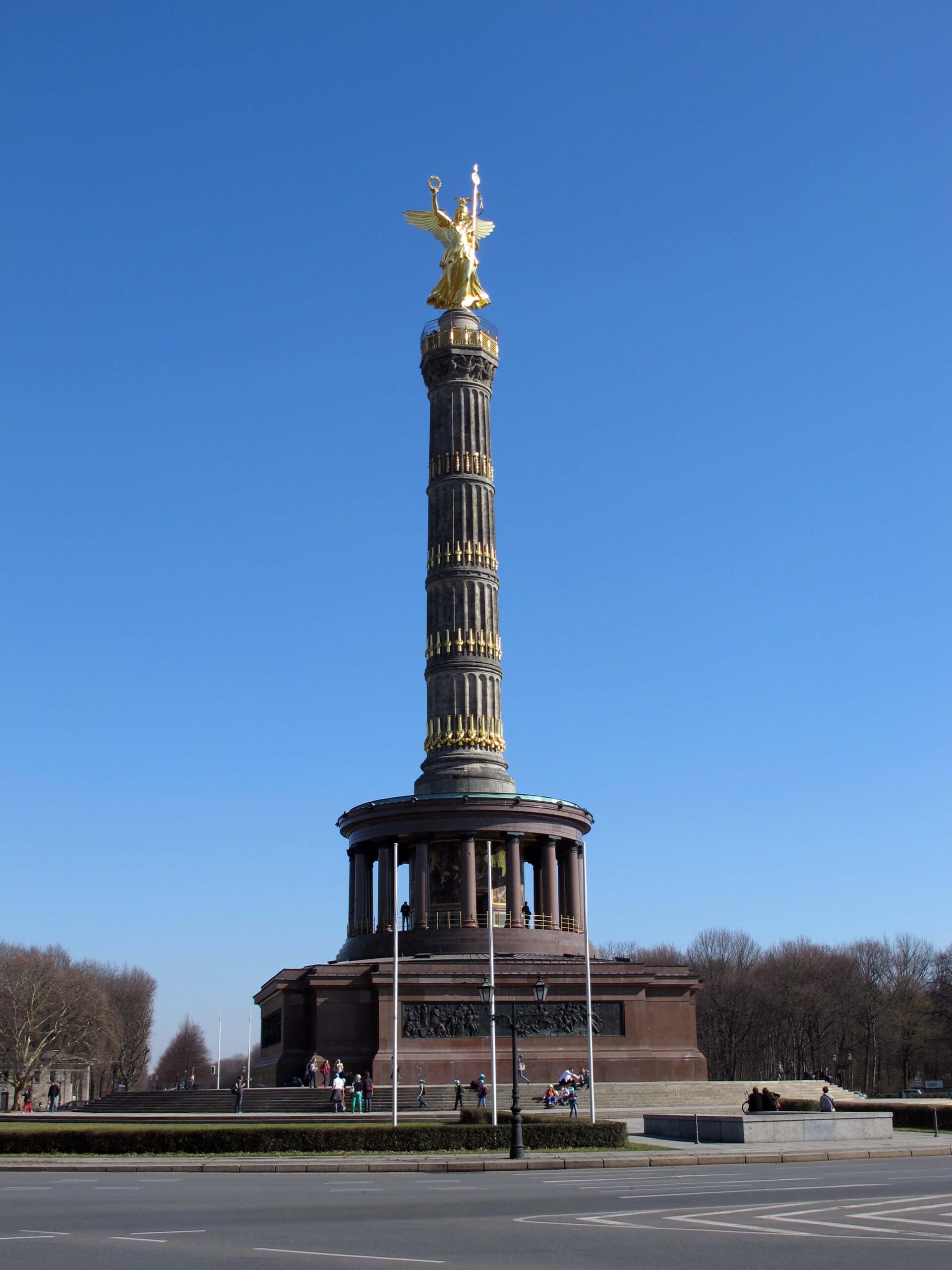
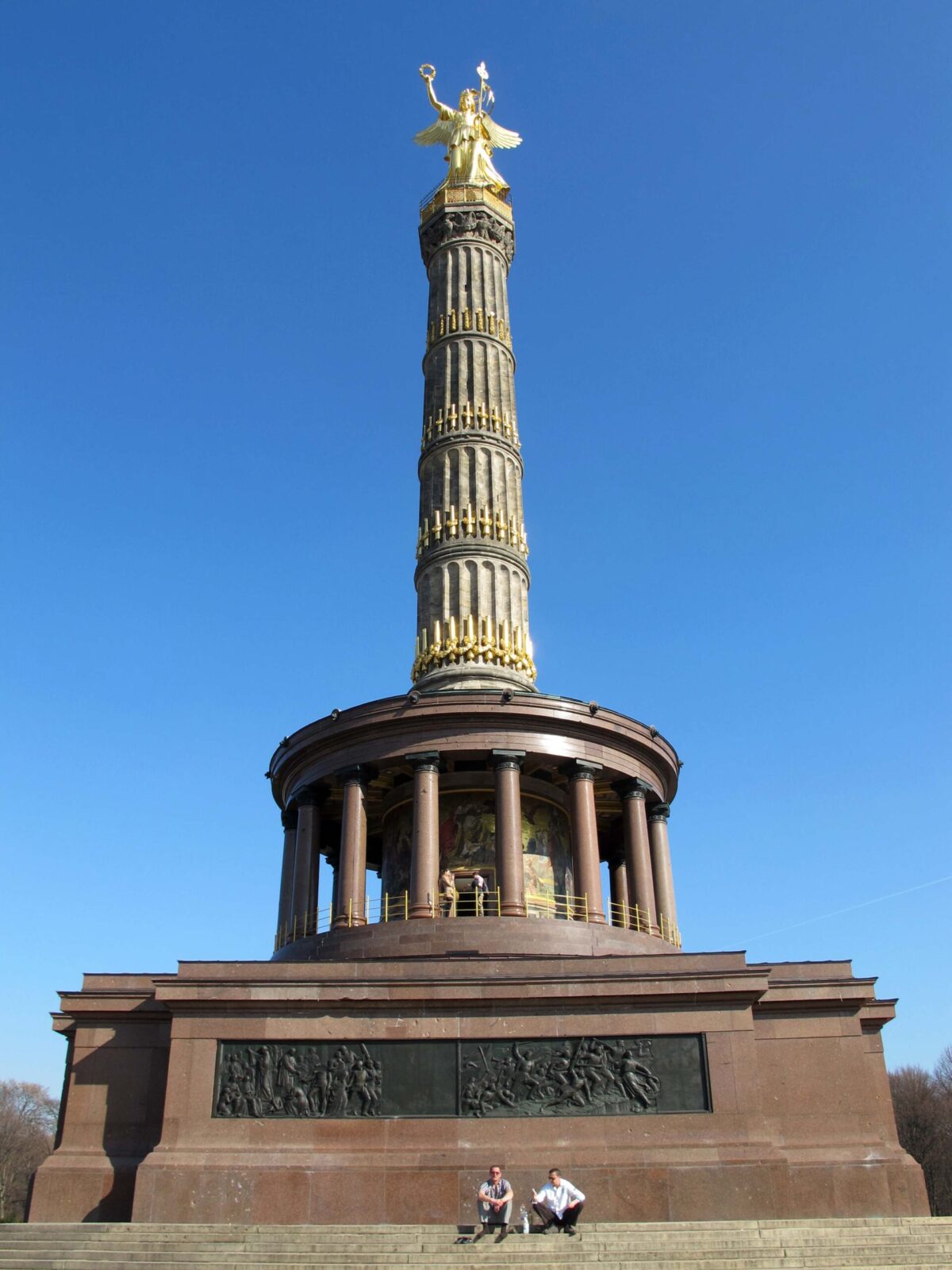
There are 4 sections to the 67m high column, the lower 3 of which represent the three wars and adorned, if that’s the right word, with cannon barrels captured from these conflicts.
More captured cannons were used in the making of the bronze bas-reliefs at the base of the monument, but perhaps even more striking is the mosaic frieze on the rotunda at the base of the column which symbolizes the founding of the second German Empire.
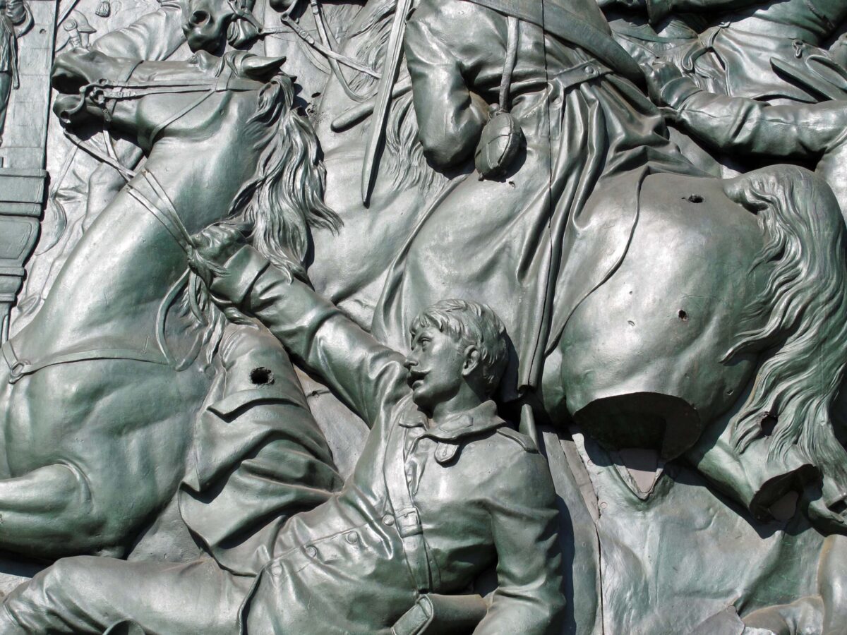
Even though the area around the Siegessaule was devastated during WW2, the column somehow miraculously survived relatively unscathed, although plenty of bullet holes can still be seen as a reminder. The same evidence can be seen on some of Albert Speer’s four neo-classical temples that serve as the entrances to the pedestrian underpass that gives access to the monument.
The Siegessaule is open throughout the year and can be reached by taking the well-used bus #100.
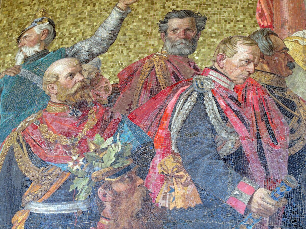
Originally posted 2018-07-31 09:30:50.
The post The Siegessaule appeared first on Easymalc's Wanderings.
]]>The post The Sony Center appeared first on Easymalc's Wanderings.
]]>The Sony Center
With the collapse of the Berlin Wall, the redevelopment of Potsdamer Platz must have been an architect’s dream. The square was divided up into four separate areas which were to be redeveloped by four different developers, one of which was the area now occupied by the Sony Center.
During the ‘Golden Twenties’, the site was occupied by ‘The Esplanade’, one of Berlin’s most prestigious hotels. Frequented by film stars such as Charlie Chaplin and Greta Garbo, the hotel was even used by Kaiser Wilhelm II who entertained guests in one of the hotel’s magnificent halls.
90% of the hotel was destroyed by allied bombing raids in the winter of 1944/45, with the Kaisersaal (as the hall became known) and the breakfast room the only rooms to survive. After restoration of what was left, it once again fell into disrepair following the building of the adjacent Berlin Wall.
After the Wall came down, what remained was listed as a historical monument, which created a problem for the architects of the new Sony Center. The outcome was that the Kaisersaal was moved 75 metres and incorporated into the new design behind a glass wall, and the breakfast room was dismantled piece by piece and re-created for the new Café Josty, the original being a popular Potsdamer Platz meeting place for artists in the early 20th century.

Designed by Helmut Jahn, the German-American architect, the Sony Center took four years to complete and was opened in 2000 at a cost of €750m.
The plaza is enclosed by a spectacular roof constructed of glass, steel and fabric and promotes Berlin’s contribution to the world of films. There are several cinemas, including an Imax theatre and a film museum. It also hosts the Berlinale, the Berlin International Film Festival.

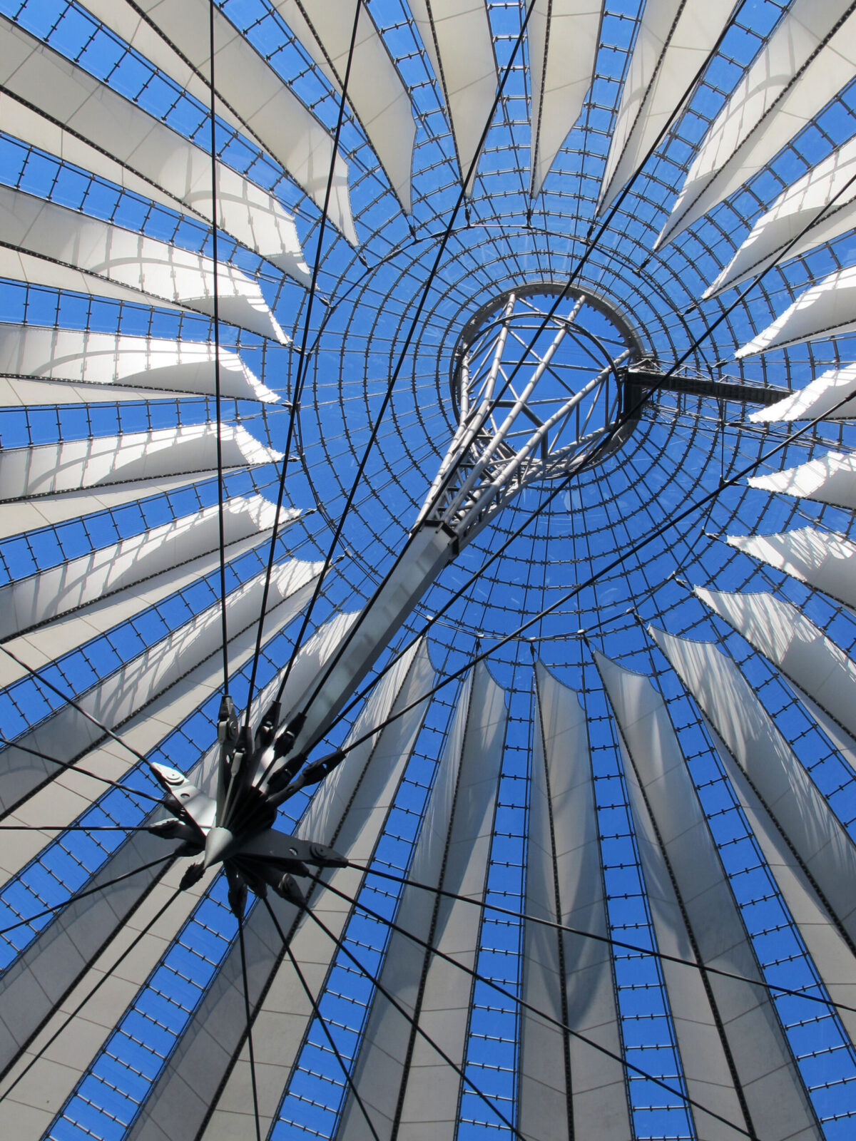

Apart from the Kaisersaal Restaurant and Café Josty, there are a number of other places to eat and drink, which are best enjoyed on an evening, when the Center takes on a completely different ambience thanks to a lighting experience put together by Yann Kersale, a Parisian lighting artist. His idea is to use the roof’s design in a way that evokes the changing colours of sunset through varying degrees of cyan and magenta. I love it!


The Sony Center attracts some 8 million visitors a year, many of them tourists. Fortunately, it’s big enough not to get too overcrowded, but to get the best seat in the house, so to speak, I recommend that you get here early enough to pull up a chair outside one of the cafes, watch the roof change from daylight through to Yann Kersale’s illuminations, and enjoy one of Berlin’s most historically interesting locations inside an icon of modern Berlin.

Originally posted 2018-07-11 17:30:37.
The post The Sony Center appeared first on Easymalc's Wanderings.
]]>The post Potsdamer Platz appeared first on Easymalc's Wanderings.
]]>Potsdamer Platz
At a point where five roads converged at the old Potsdam Gate, Potsdamer Platz became the busiest and most recognized intersection in Germany – if not Europe. It became so busy that Europe’s first recognised traffic lights were installed in 1924 to help keep things moving.
Its heyday was during the Roaring Twenties, when film stars such as Marlene Dietrich helped catapult Berlin onto the world stage of show business. It was the place to be and be seen. Grand hotels were built to accommodate the rich and famous, as did luxury stores, bars, and restaurants. The inter-war years had been good to Berlin, but it wasn’t to last.


WWII dealt it a devastating blow. Situated as it was, near to Hitler’s Reich Chancellery, it took the full brunt of several air raids that reduced it to rubble. Very few buildings were left standing – the Weinhaus Huth being one notable exception.


After the war was over, the square fared little better. The Soviet, American, and British zones collided at Potsdamer Platz and when the Berlin Wall was built it ran straight through the middle, leaving the area a total wasteland between the eastern and western sectors.
With re-unification came a blank canvas for Europe’s largest building site and the area is now a thriving intersection once again. The modern architecture may not appeal to everybody, but whatever your thoughts about it are, there’s no denying that Potsdamer Platz has now become one of Berlin’s places to come to once again.


Originally posted 2018-07-10 13:40:59.
The post Potsdamer Platz appeared first on Easymalc's Wanderings.
]]>The post Alexanderplatz appeared first on Easymalc's Wanderings.
]]>Alexanderplatz
Alexanderplatz, or Alex, as it’s known to Berliners is a windswept pedestrianised plaza doubling up as a meeting point and transport hub in what used to be East Berlin.
It was the downtown centre for the locals when it was behind the Iron Curtain, and now one of the main focal points for the united Berlin of today – and no visit to the city would be complete without visiting Alex.
The square was the communist authority’s idea of a modern cityscape, and although it’s had its fair share of critics over the years, it wouldn’t surprise me if there wasn’t a fair number of people who wouldn’t want to see it change too much either.

A building that probably wouldn’t be missed very much is the Park Inn which towers over the square. I’ve stayed here a couple of times and it has to be said that the views from the hotel are fantastic, but from an architectural point of view it’s a typical 1960s tower block with no real merit and too much of a presence over the surrounding area

Many buildings have come and gone since the area started out as a livestock market in the Middle Ages, but it was the visit of the Russian Tsar Alexander I that gave the square its name in 1805.
Alex has seen many ups and downs over the years, being seedy one minute, and upmarket the next. WWII dealt it a heavy blow when much of the area was destroyed, but two buildings of note survived – Alexanderhaus and Berolinahaus.
They were designed by the modernist architect Peter Behrens and built between 1929 and 1932 in a new style that became known as ‘New Objectivity’. His plans were to enclose the square with several buildings, but with the depression and rise of fascism in the 1930s these two buildings were the only ones completed.
Having survived the war and post war re-construction, they were given protected status in 1975 and renovated between 2004 and 2006.

Another large building that would be impossible to miss is the Galeria Kaufhof. Today, it looks just like any other store, but when it was opened as Centrum in 1970 it was not only the largest store in the GDR, but somewhere that sold goods that most people could only dream of, including items imported from the ‘West’. Ironically, outside the store these days are people now selling ‘GDR and Russian military caps and hats’ to people from the West!

Nearby is a fountain built in the 1960s called Friendship among Nations and a great meeting point, but probably the most famous meeting point and also the most photographed object in the plaza has to be the World Clock.
Being such a large open space, Alexanderplatz has attracted a fair number of demonstrations over the years, but none bigger than the anti-government rally just before the wall came down in Nov 1989. It’s been estimated that up to a million people joined the demonstration.
A lot of water has gone under the Schlossbrucke since then but Alex has been largely untouched by new development, which I’m sure will please those who still miss the old East Berlin days.
Ostalgie is still alive and well in some East Berliners minds, and even though I’m not sure I would have wanted to have been living here I do understand some of that thinking. From purely a tourist’s point of view though I’m also pleased that Alexanderplatz hasn’t changed too much, but whether that situation lasts, only time will tell.

Originally posted 2018-05-04 21:42:13.
The post Alexanderplatz appeared first on Easymalc's Wanderings.
]]>The post Grenoble – Capital of the Alps appeared first on Easymalc's Wanderings.
]]>Grenoble - Capital of the Alps
Before coming to Grenoble I was somewhat surprised to learn that it’s often referred to as the ‘Capital of the Alps’: After all, the Alps run for 750 miles between France and Slovenia, and Grenoble is at the extreme western edge of the mountain range – and as far as I’m concerned, is not actually even in the Alps.
I thought that maybe somewhere like Innsbruck would have a better claim to the title, so I looked it up and can you guess what I found? Yep! That’s right, Innsbruck is also called the capital of the Alps.
I’ll leave it to the powers that be to decide which they think is the best candidate for the title, but if nothing else, it did focus my mind a bit more on how the city of Grenoble sees itself.
There’s no doubt that its location in south-eastern France, where the Rivers Isère and Drac meet, would have been a natural place to build a settlement, and from its humble Gallic beginnings in 43 BC, Grenoble has grown into a fair-sized city.
The official population is around the 160,000 mark, but if you include the sprawling suburbs of the metro area that stretch up through the valleys either side of the Chartreuse Massif, the population is nearer to 700,000.

Grenoble is not a city that is devoid of any history, but it struck me that it was much keener to look towards the future rather than dwelling on the past.
The large university, for example, adds youth to the city’s character and provides labour for the high-tech industries, such as the Nuclear Energy Commission, European Molecular Biology Laboratory and the European Synchrotron Radiation Facility. That’s quite a mouthful I know, but I’m sure you get the gist.
At the heart of the city though, there is still an Old Town (Vieille Ville), but whether this was where the original settlement of Cularo was, I couldn’t say because the historians aren’t sure either. What they are sure about though is that by the 4th century AD the fortified Roman town of Gratianopolis took its place.
It wasn’t a particularly important town, just a regional centre, and after the Romans departed, it fell into relative obscurity right up until the Middle Ages when it became a city divided by the ruling Counts of Dauphiné and the local Bishops.

At the time, Dauphiné was a state and not a part of France, and the Counts (who were known as Dauphins), ruled from the area around Place St. André. The church of the same name was the family’s private place of worship and final resting place, but as churches go it’s nothing exceptional, but it’s worth paying it a visit, if only to see where the Seigneur de Bayard is laid to rest.
Pierre de Terrail Seigneur de Bayard, to give him his proper title, was a late 15th/early 16th century French knight more commonly known as the Chevalier de Bayard, and if you were wondering who the character on the plinth in the middle of the square was, well now you know.
Place St. André is probably the best place to soak up the atmosphere of the Old Town, but as this was late December (between Christmas and New Year) there wasn’t a lot of point in hanging around, and so we popped into the Café de la Ronde for a coffee to warm up.
As you would expect, it had all the ambience that only a French café can have, but more than that it claims to be the second oldest in France after the Café Procope in Paris.


As much as I could have stayed in here all day, it was time to move on and check out the rest of the Old Town. Even though it was the ‘Twixmas’ period it was good to see that the markets were still operating – one in the Place aux Herbes and another in the St. Claire Halles. Other than that, it was the wrong time of the year for sightseeing really. We stopped off at the Notre Dame Cathedral, which didn’t actually set my pulse racing, and moved on to the Isère Resistance and Deportation Museum.


Some of you will know that I have an avid interest in events of the 20th century, the Second World War being one of them, but before you dash off, I’d like to reassure you that I’m not going into any significant detail here about a forgotten army of brave people who fought and died for France during the Nazi occupation. It wasn’t just those who fought against Petain’s Vichy government who are remembered here, but also the Jews that were sent east to those places that they never ever returned from. Enough said.


One of the things that travel does is open your mind to things that you never realised before, and visiting this museum was one of those things. Now that I’ve been to this region, I can start to understand what those resistance fighters were up against, because we were now off up to the Bastille – and the highlight of any trip to Grenoble.
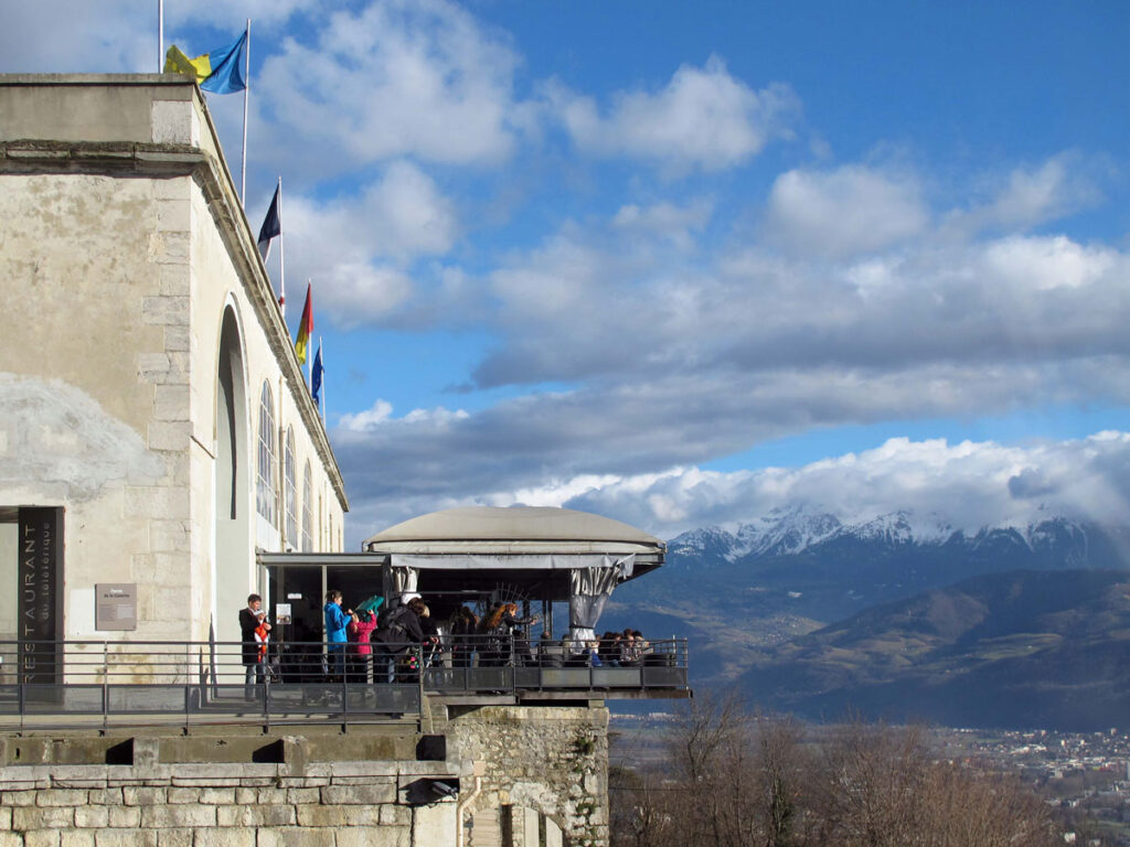
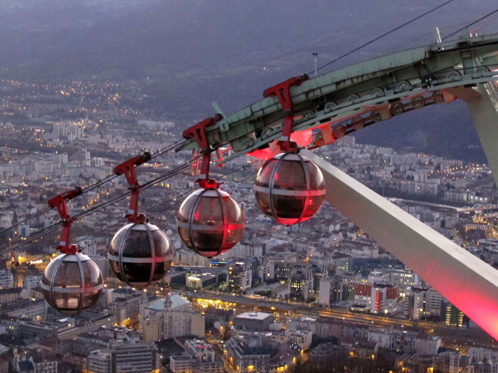
There are two ways to get up to the Bastille – you can walk, or you can take the Bubbles, a cable car that some people might not care for too much, but for me it would be the Bubbles every time. Before I go any further, I would have to say that the Bastille isn’t very exciting from a monument point of view, but the view from the Bastille is incredible.


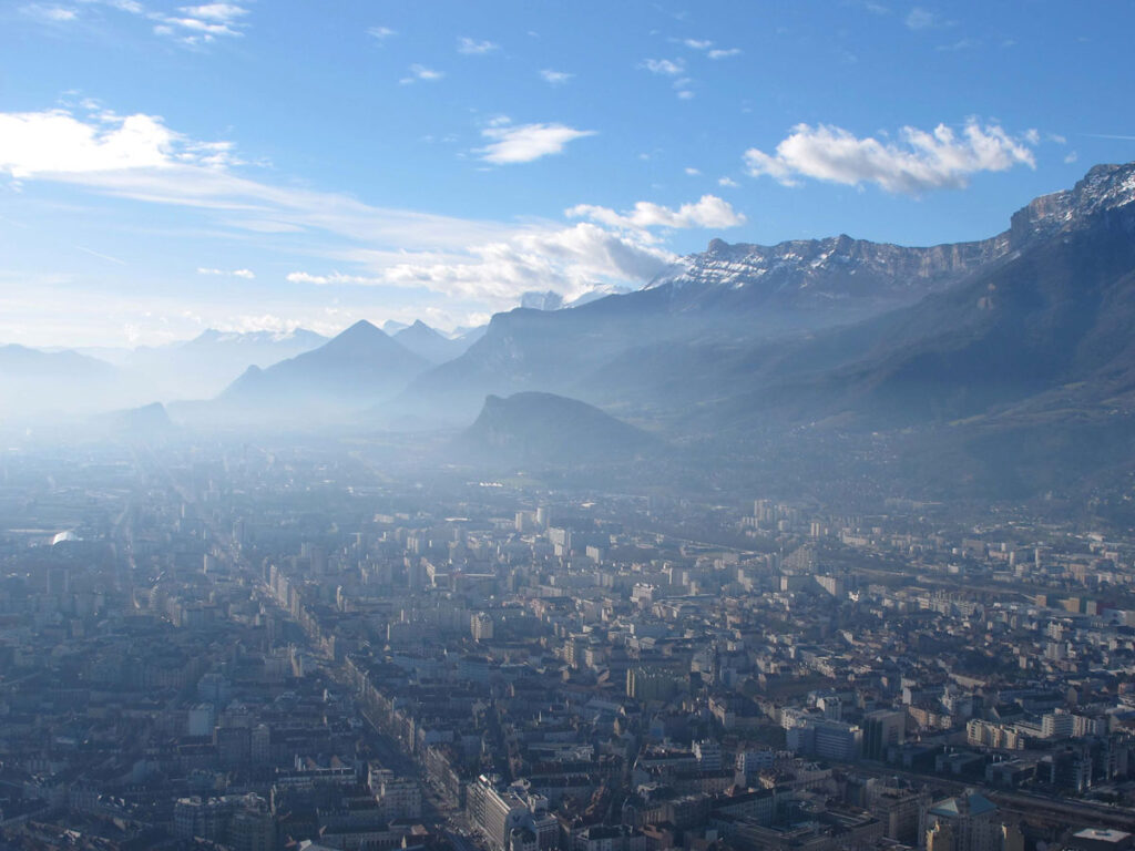
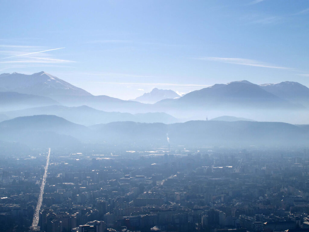
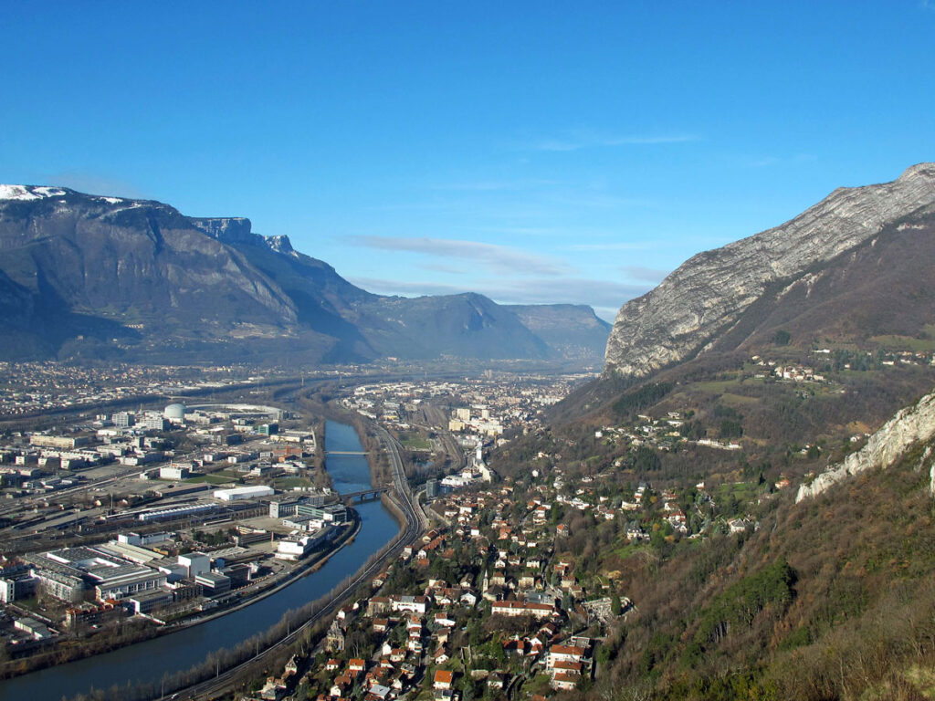
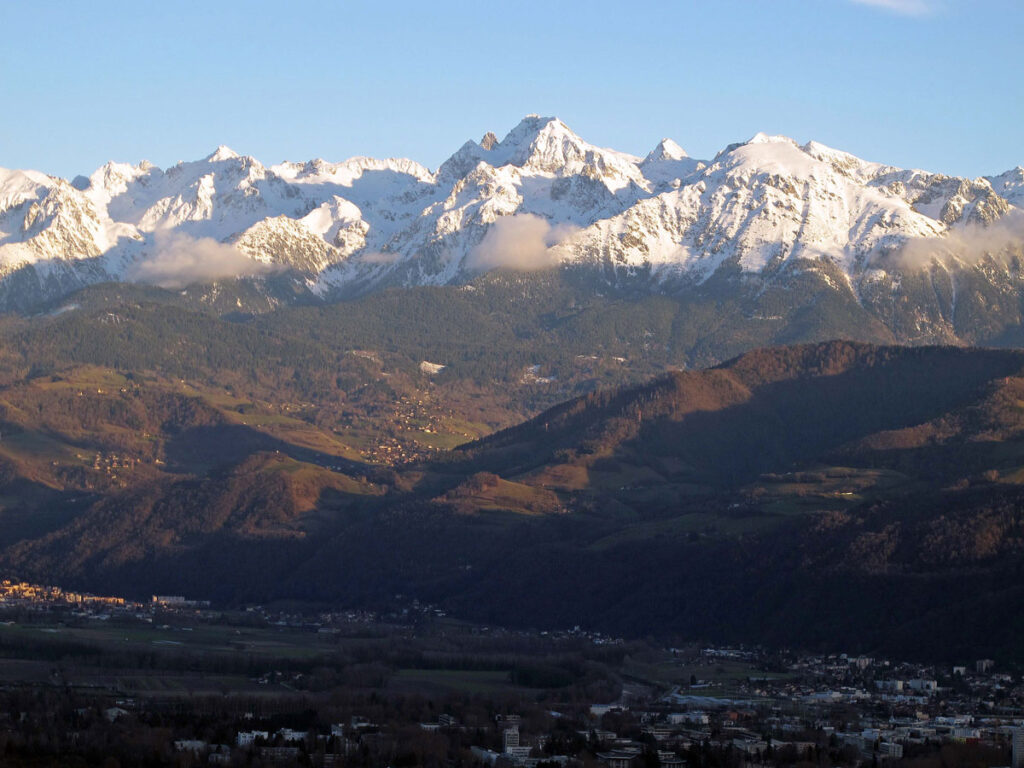
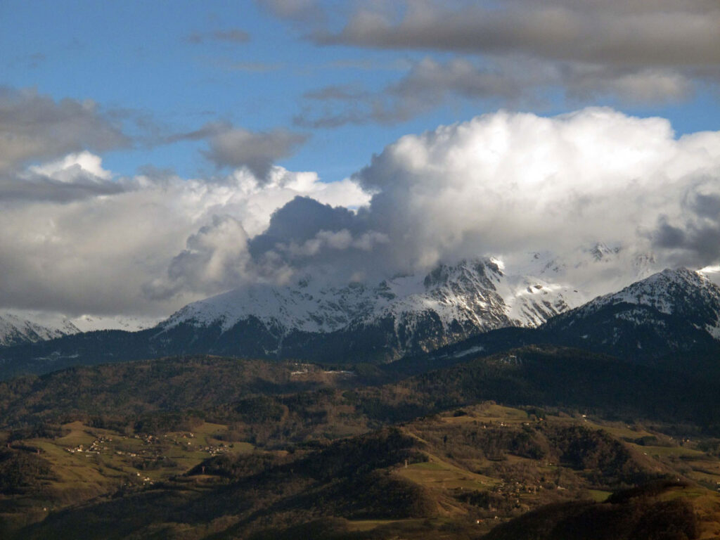
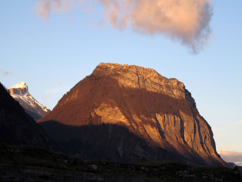
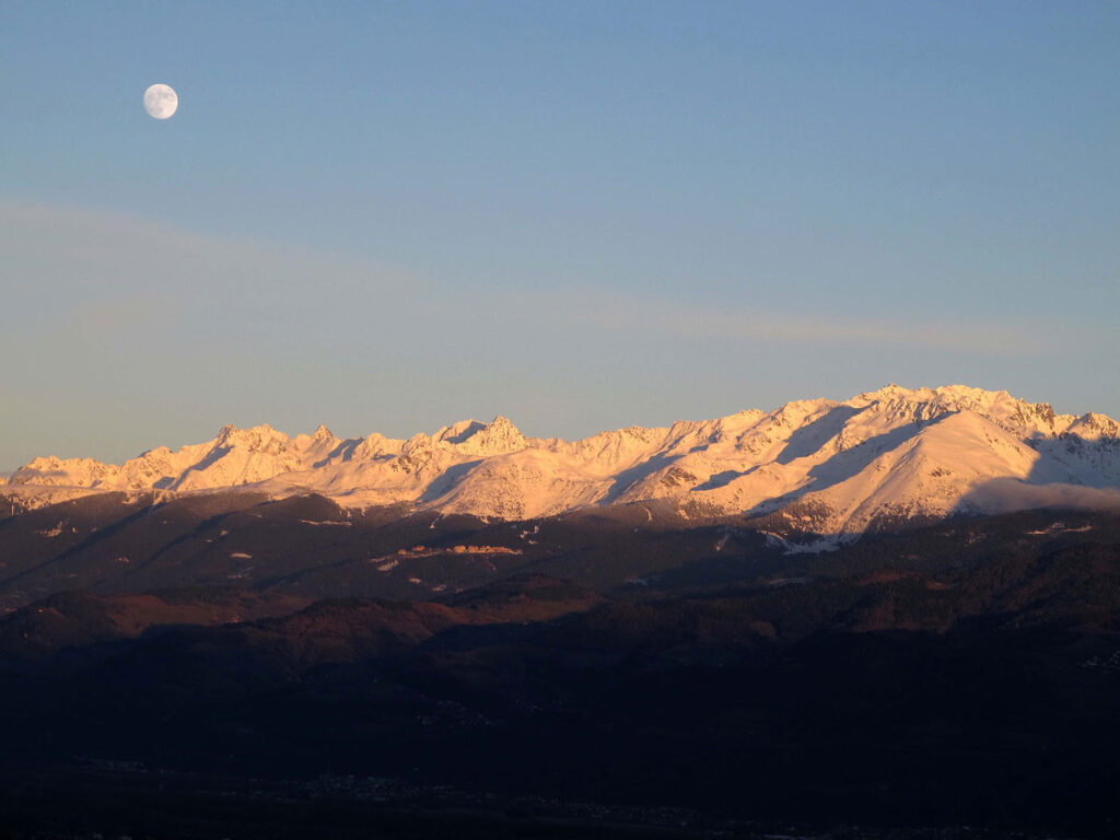
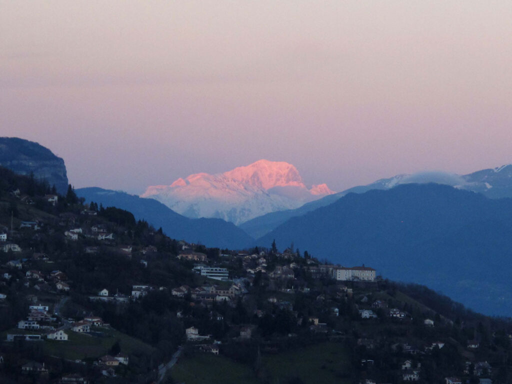
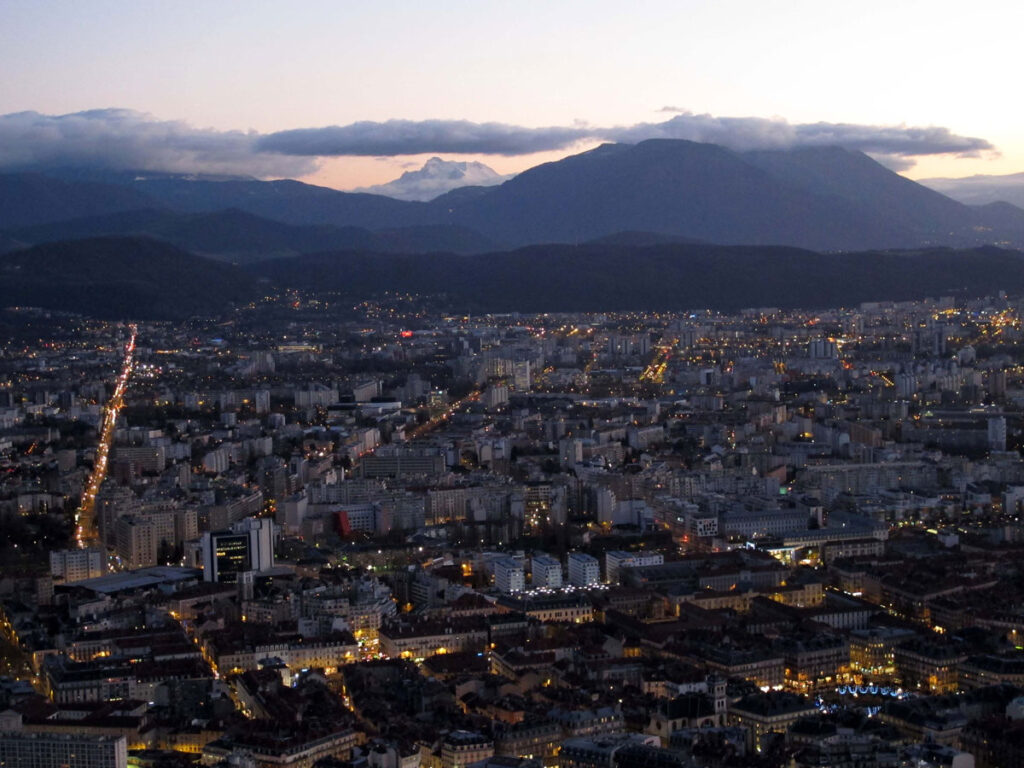
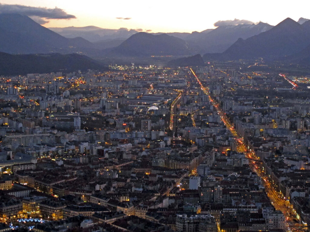
From here you can see how Grenoble is surrounded by mountains – the Chartreuse, the Belledone, and the Vercors: You can even see Mont Blanc, 70 miles away, and I could now start to understand the terrain that those resistance fighters were having to contend with. My mind wanders off in all sorts of directions when I think of these things, but that’ll do for now – let’s just get back to those views.
It’s only when you come up here that you can see the reason why Grenoble was awarded the Winter Olympics in 1968 and why it sees itself as the Capital of the Alps. I’ll stop talking now, and just let you enjoy the views.
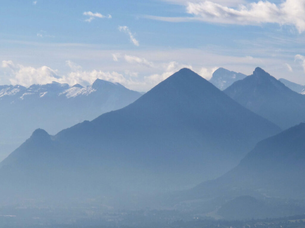
The first carousel shows some views of the Vercors first thing in the morning, the second shows some views of Grenoble and the Belledone from the restaurant during the day, the third shows the Chartreuse, the Belledone and Mont Blanc as the sun went down, and finally, Grenoble as the lights came on.
Originally posted 2019-10-08 05:33:40.
The post Grenoble – Capital of the Alps appeared first on Easymalc's Wanderings.
]]>The post The Changing Face of the South Wales Valleys Pt 3 – The Effects of the Strike appeared first on Easymalc's Wanderings.
]]>The Changing Face of the South Wales Valleys Pt 3 - The Effects of the Strike
“The Miners united … will never be defeated” was the battle cry from striking miners – but they weren’t united, and even though the South Wales miners were more united than anywhere else in the country, there were still those that went back to work before the strike ended, and that was bound to make life difficult when they had to start working together again.
There must have been other misgivings too, because although there was a wage packet being picked up again at the end of the week, they must have wondered for how long, and in the case of Bedwas Colliery, they knew straight away because it never even re-opened. By the end of 1985 another seven South Wales pits were either amalgamated or closed down, and it was the same story throughout the country.
Fortunately, Tower wasn’t one of them, and if you’ve read my previous post, The Changing Face of the South Wales Valleys Pt 2, you’ll already know why I’m pleased to say that. These people may have had a lot to contend with, but they hadn’t forgotten our support either, and they invited us to a special evening at the Fernhill Social Club to thank us for that support.

The evening promised to be a memorable one. NUM officials would be there, and so would the Mayor of the Rhondda. The Treorchy Male Voice Choir would be singing a special song written for the occasion, and of course this time there would be no shortage of food on offer. All we had to do was turn up.
The evening was indeed a memorable one, but for all the wrong reasons. Purnell Gravure got hold of a vintage coach and all the wives bought new frocks and got their hair done. I’m afraid it all gets a bit hazy after this. All I remember was that it was a Friday night and it started off perfectly. Everyone picked the coach up on time and we were soon heading for the Severn Bridge, but it then all started to go horribly wrong. We left at 5pm for the 8pm start, but heavy traffic on the M4 approaching the bridge meant that we were in danger of not making it on time.
Things went from bad to worse. It was dark and wet by the time we reached the Rhondda and it wasn’t easy to see the turning off for Blaenrhondda, and we went past it. When things go wrong, sometimes I’ll take the responsibility but not the blame, and sometimes I’ll take the blame but not the responsibility. On this occasion, I had to take the blame and the responsibility. It was all my fault. I was the one directing the driver, and he wasn’t the happiest person I’ve ever met when we found ourselves at the top of the valley heading for the Brecon Beacons.
We pulled in and onto a patch of industrial waste ground to try and turn around, and the next thing we knew there was a great big thump. When we jumped out to see what had happened, the front of the beautiful vintage coach didn’t look quite so beautiful now. The bumper was hanging off for a start, and not only that, we were stuck in a wet morass of mud and slag.
It was all hands to the pump, even the ladies in their new frocks were giving it a go, and it didn’t help that it was chucking it down with rain either. I won’t tell you what everyone looked like in their finery trying to push the coach out of the mud with the wheels spinning.
The miners sent a search party out to look for us and it was around 10pm when they found us. A few cars took some of us down to the club while the others stayed with the coach. When we arrived, the food had nearly all gone, and the mayor most certainly had. I think it’s fair to say that what should have been one of the proudest moments of my working life, wasn’t. I did receive some awards including a statue of a collier made from coal, some badges, and a couple of NUM ties as well as being made an honorary member of the NUM, but somehow, I didn’t feel quite as proud as I should have done.


I can’t really remember much else because it all became a bit of a blur. I think I just wanted one of those pits to swallow me up. From what I can remember, some of the miners helped get the coach moving again and the rest of the coach party turned up when nearly everybody else had gone home.
The Treorchy Male Voice Choir never got to sing that song either, which was a great shame, because they did a rehearsal of it, in both English and Welsh when I was in the club one time, and it was really very moving. It would have been a fitting end to the evening. As it is, the best I can come up with is them singing a rendition of ‘Cwm Rhondda with the Morriston Orpheus Choir instead. This is my attempt at an apology to that wonderful group of singers.
Our journey back home to Somerset was a lot quieter than I was hoping for, and instead of making a whole new load of friends for life, I think I had less than when we started out.
Back at the coal face, 1986 saw more pit closures, and when Maerdy amalgamated with Tower, it effectively brought coal mining in the Rhondda Valley to an end (see picture at the start of this post).
Margaret Thatcher’s defeat of the miners encouraged her to take on the rest of the union movement, and with the legislation behind her, it wasn’t long before she accomplished that aim as well, but unfortunately for her, she wasn’t able to control members of her own party, and in 1990 she resigned. Her reign as the unofficial queen of England lasted 11 years, in which time 115 pits were closed, considerably more than the 70 Arthur Scargill was ridiculed for suggesting would happen.
She was succeeded by another conservative prime minister, John Major, who privatised British Coal in 1994 after announcing the closure of another 55 pits, one of which was Tower. The mine was closed on 22nd April 1994 but was back open again on 2nd January 1995 after being bought by the miners who worked at the pit. It carried on producing coal right up until 2008, even though John Major said pits like Tower were uneconomical.
The NUM’s lack of influence enabled the coal dependent industries to import cheaper coal from around the world, even though there were still vast reserves in the UK, and by 2001 coal production was exceeded by imports for the first time. Since the early days of Thatcherism, the country was fast becoming a post-industrial nation, with steelworks, shipbuilding and manufacturing joining the collieries into the dustbin of industrial history.
Service industries stepped into the breach and ‘Privatisation’ and ‘Market Forces’ were the new buzz words. The financial sector was benefitting the most, and there was no better example than Canary Wharf in London, which had become a desolate wasteland after the docks were closed down and the East End dockers’ families cleared out of the way for the powerful multi-national financial institutions that were to take their place. In contrast, in 2006, I came back to the Rhondda to see how things had changed since that last inauspicious evening back in 1985.

We decided to have an overnight stay at the Heritage Park Hotel, which was located right next door to the Rhondda Heritage Centre in Trehafod. Since then, it’s been re-named the Welsh Mining Experience for some reason, but whatever they want to call it, this was the site of the former Lewis Merthyr Colliery which closed in 1983.
The attraction was officially opened on 11th September 1989 by Peter Walker, Secretary of State for Energy, which seems an odd choice after what the conservative government had done to the industry, but at least there was some recognition of what coal mining meant to the area.
I’m not going into the history of the pit or the tour around the attraction here, but I can’t pass by the opportunity to speak about what I thought was a chance encounter with somebody from Blaenrhondda. It was in fact, a put-up job, which on reflection, I thought was a wonderful gesture. Thanks to the staff, and in particular, Peter Arundell, the tour guide, my wife and I were to meet Teifi and his wife from Blaenrhondda. To be honest, I can’t really be sure if that was his name or not, but that’s what it sounded like (and before you ask, I’m sure it wasn’t Taffy).
This grand old boy of 81, and his wife of 80, were able to remember our visits with the food parcels. They not only knew Dai and Rae Lewis, but were also related to them. I may have been hearing things, but it sounded like Dai was one of 24 children, one of his sisters had 26, and someone else (I’d lost track by now) had another 22. I can see now why men were called names like Dai the Butcher, Bryn the Baker, and Gareth the Candle-Sick Maker. For somebody like me who gets the next-door neighbour’s name wrong for nearly a year, it all gets a bit confusing. Anyway, I digress. These two were a mine of information (excuse the pun), and we spent a long time mulling over the events of the strike. I’m sorry I can’t remember Teifi’s wife’s name, but she made me smile when she said she would have liked to have invited Maggie Thatcher round for a cup of tea – “just the one mind you”.
They also invited us back to their home, not just for a cup of tea, but to spend the night. I felt really guilty that we had to tell them we were booked into the hotel next door. Our journey from the M4 up to Trehafod had already shown us that the area was changing – but one thing that didn’t appear to be, was the generosity of the people themselves.

Yesterday’s journey up to Trehafod from junction 32 of the M4 showed changes which some people would say were not a bad thing. The road to Pontypridd had been vastly improved, and the Nantgarw coking plant was no longer here. I don’t think anyone could put hand on heart and honestly say that working underground is a good way of earning a living, but I suspect that many miners would want those days back again if they could, no matter what I think.
After our overnight stop at Trehafod, we headed back up the Rhondda Fawr to see how things were up here, and to be honest it all looked a bit forlorn to say the least. The miners, as I’ve said before, were not just fighting for their jobs, but their communities too – and here was the living proof. Driving through Ystrad, Ton Pentre, Treorchy, Ynyswen, and Treherbert, there seemed to be a general air of gloom and despondency about the place, and this was a picture that was taking place throughout Britain. There was a saying that “Maggie knew the cost of everything, but the value of nothing”, and that’s how it seemed to many people. While the money men were adding zeros to their accounts in Canary Wharf, communities in post-industrial Britain were left to wait in dole queues where, what jobs there were, paid the least amount they could get away with now that trade unions had been left impotent. It was this sort of mentality that brought people to form unions in the first place.

As we approached Blaenrhondda I couldn’t help but think that the valley has had the lifeblood sucked out of it, and yet at the same time, I couldn’t help but think that it needn’t have been quite like this. I know it’s easy to say with hindsight, but I’ve always gone by the philosophy that “It’s better not to fight, than to fight and lose”.
Arthur Scargill’s prediction about wholesale pit closures were proved to be correct, but he was up against a formidable opponent, as well as the added problem of power stations changing from fossil fuels to a cleaner alternative. I’ve already mentioned that I think he should have called a national ballot when the majority would have supported it, but he had a get out of jail card in November 1984 when the arbitration service, ACAS, got involved. If Scargill had put forward a recommendation to his NUM members to accept the compromise on offer, and they had accepted it, not only would the miners have not been defeated, but they would have been seen to come off best in the deal as well. Any good card player will you that you that you need to ‘know when to hold ‘em and know when to fold ‘em’. If only Arthur Scargill would have realised that.
All that is history now of course, and to be fair, not all of the news on my visit in 2006 was bad. I could see some positive changes too. The hillsides were starting to turn green and the Rhondda River, if not sparkling, was looking cleaner than ever: Even if life was still hard for many, nature can be very resilient too, and it was beginning to show us humans how we can make our lives better in other ways. When the threat from this Co-vid 19 virus allows us to safely move around again, I intend to come back up to South Wales and finish The Changing Face of the South Wales Valleys with the final part of the story. I’m just hoping I haven’t got to wait too long.


Originally posted 2020-06-26 09:37:46.
The post The Changing Face of the South Wales Valleys Pt 3 – The Effects of the Strike appeared first on Easymalc's Wanderings.
]]>