Tag Archives: Boat Trips

Looe Island

Looe island

Looe Island is just a mile offshore, but the short boat journey from the quayside at East Looe will transport you into what seems like a totally different time and place.

The island is owned and managed by the Cornwall Wildlife Trust and access is usually only permitted by using the authorised boat that runs from Buller’s Quay. The boat runs from Easter to September, two to three hours either side of high tide, and of course, weather conditions permitting.

The boat trip costs £7 return per adult and there’s also a landing fee of £4 per adult (July 2018).


Continue reading →

Originally posted 2018-07-16 12:08:22.

Wandering Around East Looe

Wandering Around East Looe

East Looe is somewhere that needs to be explored, and as such this stroll around town isn’t meant to be a definitive trail, but a guide as to what can be seen when wandering around.

With this in mind, the bridge that connects East and West Looe is still a good place to start, as it’s probably the first thing that visitors will see when entering the town for the first time, as well as being one of its most important historical features.

The first bridge to be built across the river was a wooden affair in 1411, but by 1436 a sturdier stone bridge was erected to join the two towns.

In a wall on the West Looe side of the bridge there’s a stone reminder of this bridge showing that it was repaired by the county in 1689. It sounds as though this medieval bridge was quite impressive, but of course time took its toll and the one we see today replaced it in 1853.

Continue reading →

Originally posted 2018-07-15 14:41:22.

Exploring the Rame Peninsula

Exploring the Rame Peninsula

The Rame Peninsula, for anybody who doesn’t know it, is the bit of Cornwall you can see from Plymouth Hoe. It’s a natural assumption therefore to think that this part of Cornwall is frequented by Janners (Plymothians) more than visitors from elsewhere, and you would be right: But you would be wrong for thinking that it’s somewhere to pass by on your journey down west, and in this post I’m going to explain why.

There are several ways of getting there, but for people with a car who like to explore I’m suggesting that we travel the long way round to begin with and drive across the Tamar Bridge, and then return to Plymouth via the Torpoint Ferry. I have my reasons for saying this, but you can travel the other way round if you prefer.

Continue reading →

Originally posted 2020-07-14 14:11:31.

North Devon Coastline From The Sea – Pt 2 Ilfracombe to Great Hangman

North Devon Coastline From The Sea - Pt 2 Ilfracombe to Great Hangman

In Part 1 of this two part series exploring the North Devon coastline, we ended up at Ilfracombe Harbour where the Ilfracombe Princess is based. The town itself is Victorian in nature and I’m not going to delve into its background here, but if you remember, we were greeted by Verity which stands on the quay under Lantern Hill.

Continue reading →

Originally posted 2025-07-24 08:43:08.

North Devon Coastline from the Sea – Pt 1 Morte Point to Ilfracombe

North Devon Coastline from the Sea - Pt 1 Morte Point to Ilfracombe

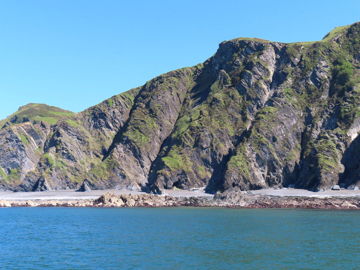
Apparently, Devon has more than 500 miles of coastline, and as far as I know, is the only county that has two coasts. Where I live on the south coast, we have a sunny, southerly aspect (when the sun makes an appearance that is) with a fairly sheltered environment. The north coast however is quite different, and there are two reasons for that. Firstly, it faces the prevailing south-westerly winds, and secondly, thanks to tectonic activity, the geology of the western side of the country has created a much harder rock than the softer sedimentary rocks on the eastern side. In other words, Britain goes downhill from west to east if you like – geologically speaking of course.

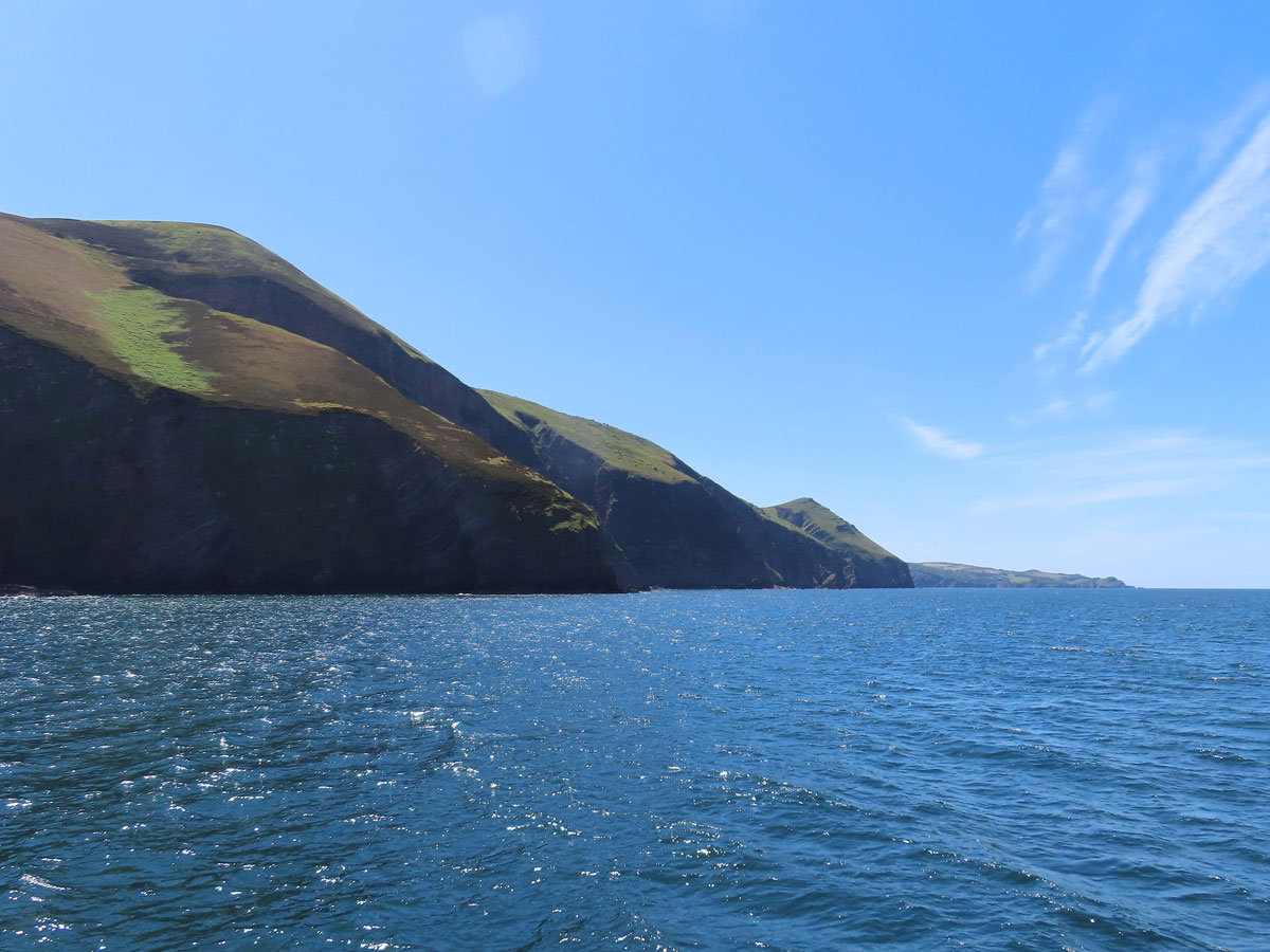
Although Devon’s south coast has some beautiful scenery, even I would have to admit that the rugged north coast is even better. Walking this section of the South-West Coast Path requires a fair bit of stamina, but as an easier alternative, and with, arguably, a better view of this magnificent coastline, it’s just as rewarding to enjoy it from the sea, and I did just that by taking two boat trips out of Ilfracombe with the Ilfracombe Princess – one that sailed west to Morte Point, and the other that sailed east to Great Hangman, which, at 800 ft, boasts the highest sea cliff in England.

Both posts will be more of a picture gallery than an in-depth study of the area, and I’m going to start off at Morte Point and work my way up the coast to Ilfracombe and then on up to Great Hangman. The whole of this coastline is a veritable ship’s graveyard, and so it seems appropriate therefore that we begin our journey at Morte Point, which literally means Death Point, so sit back and enjoy this fabulous coastline from the comfort of your armchair without the need to reach for the seasick tablets.

Continue reading →

Originally posted 2025-07-10 16:28:41.

Topsham

Topsham

Topsham is a village/small town on the eastern bank of the River Exe just 4 miles or so from Exeter’s city centre. Since 1966 it has officially been part of Exeter, but its distinctive character makes it feel very different from its larger neighbour.

It started out as a Roman settlement and developed as a port which grew in importance following the construction of the weir at Countess Wear. Even with the arrival of the canal in 1566 it still prospered as trade boomed with the Dutch who came for Devon wool. The Dutch influence can be seen all over Topsham with gable-fronted houses, some of which were built with the bricks that were used as ballast for their ships.

The port is no longer vital to Topsham’s prosperity as it has now become a desirable place to live for people who like to live near the city but not in it.

The River Exe and the surrounding marshes have an abundance of birdlife, and places like Bowling Green Marsh are protected habitats for the large flocks of waders, geese and migratory birds that also make Topsham their home.

Continue reading →

Originally posted 2018-12-25 04:51:57.

The Exeter Canal

The Exeter Canal

Exeter has a perfectly good river on its doorstep so why was there a need for a canal you may ask. For the answer to that we need to go back to the late 13th century when the Countess of Devon, a member of the Courtenay family, built a weir across the river just upstream from Topsham in order to power her mills on either side of the river.

Up until this point the river was navigable up to the city walls, but the weir made it difficult for boats to reach the city even though the Countess left a gap in the middle of the weir. Worse still, in 1311 her cousin, Hugh de Courtenay, blocked the central section, effectively forcing the ships bound for Exeter to unload at his quay in Topsham.

The Courtenay family were very influential and Henry Courtenay, the 1st Marquis of Exeter, was a close friend of King Henry VIII, which was just asking for trouble if you ask me, and the Marquis unsurprisingly ended up losing his head on Tower Hill in 1539. Falling out of favour with the King meant that all his lands were confiscated and the city of Exeter was eventually granted the right to tear down the weir. Unfortunately, it was all a bit too late as the river had silted up, and to overcome the problem it was decided to build a canal linking Countess Wear (!), as it became known (and still is), to the city.

Continue reading →

Originally posted 2018-12-23 15:20:09.

Exeter Quayside

Exeter Quayside

The Roman and medieval city of Exeter grew up on a hill overlooking the River Exe, which means that the river runs below the city rather than through it. This also means that it requires an inconvenient 15-minute walk downhill from the city centre (unless you follow the nicer walk alongside the City Wall), or an even more inconvenient bus service to get here. That said, get here you must, because it’s one of the most enjoyable parts of the city.

A Celtic tribe called the Dumnonii were the first people to settle here, and although there doesn’t appear to be any hard evidence, it seems likely that they were trading at the Quayside before the Romans arrived. You might have expected the Romans to be trading here themselves, and although they probably did, their main port was at Topsham, some 4 miles downstream.

Even so, by the Middle Ages, trade was flourishing on the Quayside – or at least it was until Countess Isabella de Fortibus built a weir across the river above Topsham to run her mills. To bypass the problem a canal was built from the opposite side of the river down to a point just below Topsham. Exeter’s influence was restored, and by the mid-18th century trade reached its peak when woollen cloth became the chief export. This cloth was stored in warehouses along with imported olive oil, wine and salt cod.

Continue reading →

Originally posted 2018-11-24 21:38:36.

Along the Lower Dart

Along the Lower Dart

Of all Devon’s rivers, the Dart has to be my favourite: From source to sea, it’s the most beguiling of rivers, and for this post I’m going to describe its charms between the lowest bridging point at Totnes to the mouth of the river at Dartmouth.

At Totnes the river is still tidal, and until the area around Totnes Bridge was drained, it was wet, marshy ground; and I suppose it must have been around here where Brutus, the first king of Britain landed – that’s if you believe the story of course – but I’ve covered more about the history of Totnes in a separate post.

Totnes Bridge was built between 1826-28 and is the latest in a long line of bridges that has spanned the river here over many centuries. Today a modern road bridge just upstream, called Brutus Bridge, has taken the brunt of the traffic, not just away from this bridge, but from the town centre as well.

Continue reading →

Originally posted 2020-11-27 14:50:56.

Torquay Harbour and Princess Gardens

Torquay Harbour and Princess Gardens

Not surprisingly, the harbour area is the main area of activity in Torquay, and has both an Inner and Outer Harbour.

The Inner Harbour is the main focal point and, just as you might expect, includes a variety of shops, bars and restaurants, as well as boats. Thanks to the pedestrian Millennium Footbridge that connects the Old Fish Quay with the South Pier, it’s possible to complete a circuit of the inner harbour without re-tracing your steps; and underneath the bridge is a cill which allows water to remain inside the harbour regardless of the state of the tide.

During the day, seagulls permitting, wandering around the harbour makes for a pleasant pastime, and there is also the opportunity to catch the ferry over to Brixham if you fancy a different harbour to wander around.

If you’ve brought Aunt Maud with you, it’s probably best to pack her off back to the hotel before the clubbing crowd turn up, especially on weekend nights during the summer. It doesn’t seem that long ago that I would have been joining them, but these days, like Aunt Maud, I find myself going home around the same time as I used to be going out.

Continue reading →

Originally posted 2019-01-26 16:04:25.

An Easy Stroll from Paignton Harbour to Goodrington

An Easy Stroll from Paignton Harbour to Goodrington

Lying at the southern end of Paignton Seafront is Paignton Harbour: It used to be known as Paignton’s best kept secret, and that’s because, until an archway was cut through an old fish cellar, many people didn’t even realise it was here. Today, the harbour is much more accessible and a lovely corner from where to start an easy stroll via Roundham Head to Goodrington.

Continue reading →

Originally posted 2020-08-19 16:36:09.