Tag Archives: Museum

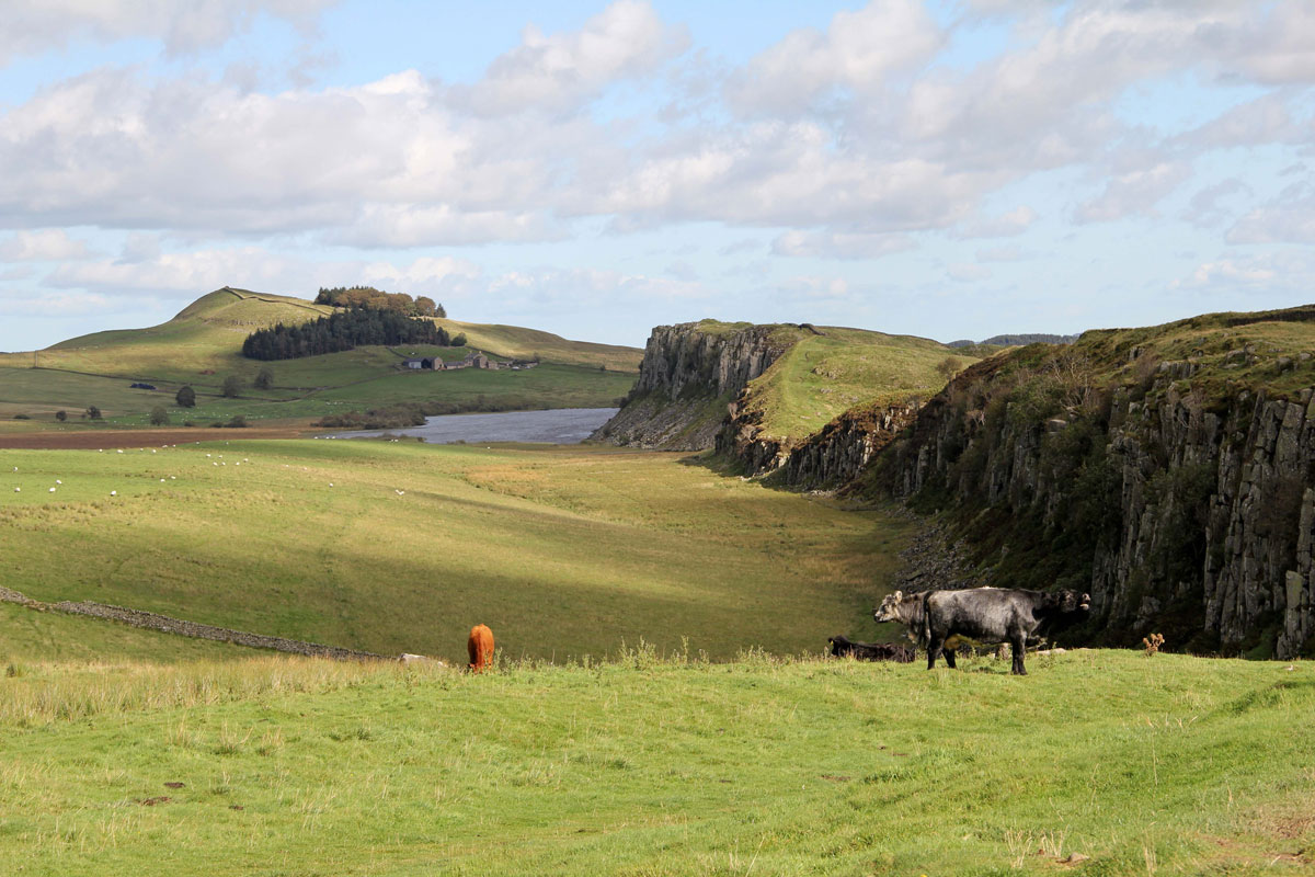
Hadrian’s Wall through Northumberland

Hadrian's Wall through Northumberland

This blog is not intended to be an in-depth historical account of the most important Roman monument in Britain, but if, like me, you have an interest, but not a degree in Roman history, and want to explore some of the more fascinating parts of this remarkable feat of engineering, then perhaps this tour will be a good starting point.

To put things in perspective, Hadrian’s Wall marks the extent of the Roman Empire in North-Western Europe, but unlike most of the other Roman borders, which used natural features, a man-made structure was needed to protect Roman Britannia from the ‘barbarians of Caledonia’.

Work started on building the wall in 122 AD and finished 10 years later. It ran for 73 miles (80 Roman miles) between Wallsend-on-Tyne and Bowness-on-Solway and did what it was meant to do for nigh on the next 300 years.

The wall also consisted of protected gates every mile (known as milecastles) with two observation towers in between (turrets), and at least 13 forts (the exact number depends on different factors).

Those people who walk the entire Hadrian’s Wall Path will get to know it intimately, but for those who can’t or don’t want to, then it has to be worth knowing where to start.

I think even the experts would agree that the Northumberland section of the wall offers the most interest, and for this post this will be the area I’m going to cover.

Continue reading

Originally posted 2019-08-02 05:06:53.

Wallsend and Segedunum

Wallsend and Segedunum

Lying about half-way between the centre of Newcastle and the mouth of the River Tyne, Wallsend is an easy and worthwhile metro ride out of the city.

As soon as you get off the train you know that you’re somewhere a bit different because the station goes by its Roman name of Segedunum, but the English name of Wallsend is perhaps just as appropriate because Segedunum was the fort at the eastern end of Hadrian’s Wall.

The wall was built during the 120s AD and was originally planned to end at Pons Aelius (Newcastle), the lowest bridging point of the River Tyne. It was then decided to extend it out here, where the river then became the natural frontier between the Roman world and the Barbarians to the north. The fort was probably built around 127 AD.

Continue reading

Originally posted 2019-02-08 21:37:23.

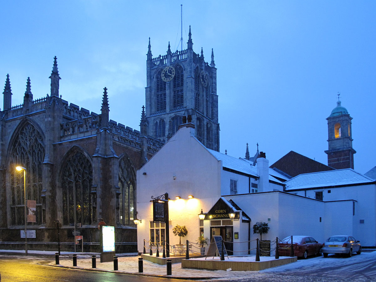
Is Hull Really a ‘Crap’ Town? – Pt 4 Minsters, Museums and Mayhem

Is Hull Really a 'Crap' Town? - Pt 4 Minsters, Museums and Mayhem

Christmas came early for the Tigers yesterday because the Robins didn’t turn up until the match was all but lost. Fans who travel a long way to see their team play at least deserve to see the players try their best even if it’s not good enough, especially when the weather makes it difficult for travelling. There were quite a number of fans from Bristol who didn’t make it in time for the start of the match, and some didn’t make it at all – but at least they didn’t miss much.

I hope those who did make it got home ok because it was snowing when we went to bed last night, and the forecast wasn’t looking that great for our final day here either. As it was the week leading up to Christmas, I thought we could try and get into the Christmas spirit and take the short train ride to the historic market town of Beverley which has always appealed to me, and I probably won’t get another chance.

The good news was that we didn’t have much more snow after we went to bed, but the not so good news was that the temperatures had plummeted again, and it was decidedly dodgy underfoot as we clambered into the taxi that took us to Paragon station. It was the same when we arrived at Beverley, but it was a bit warmer as there was a lot more cloud around.

At the station there was a machine that sold maps for a pound, a practice that had been introduced in lots of places, but it’s like putting your money into an amusement arcade slot machine. Sometimes you win but most of the time you lose, and after trying my luck, we headed off towards Wednesday Market a quid lighter – and no map.

Continue reading

Originally posted 2023-10-22 09:35:56.

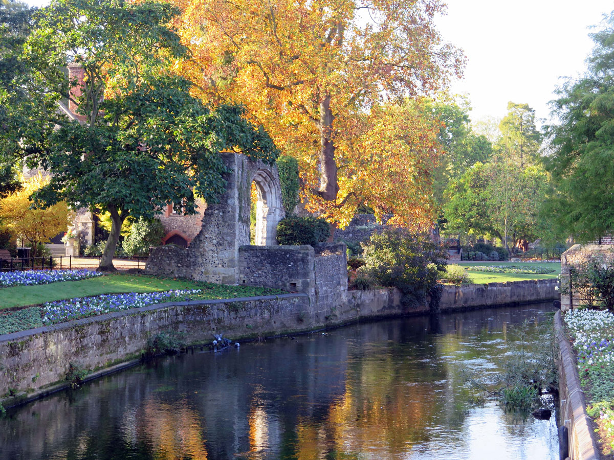
Wandering Around Old Canterbury

Wandering Around Old Canterbury

I don’t suppose this blog about our visit to Kent’s most historical city will rank alongside Geoffrey Chaucer’s Canterbury Tales, but hopefully it will show that there is a bit more to Canterbury than just its cathedral.

Admittedly, we didn’t have time to see everything that the city has to offer, but enough to show us why people, other than pilgrims, should make a journey here.

I think it’s fair to say that most people will come here to see the Cathedral, and maybe St. Augustine’s Abbey, but there was a town here before St. Augustine arrived. The Roman town of Durovernum (“the stronghold amidst alders”) included a protective wall which was probably built around 270 – 280 A.D. This wall continued to be used, with improvements, right through the Anglo-Saxon and Norman periods into the Middle Ages, and still surrounds around half of the old city today. Inside this wall is the most interesting part of the city and the focus of this article.

Continue reading

Originally posted 2020-04-01 13:00:43.

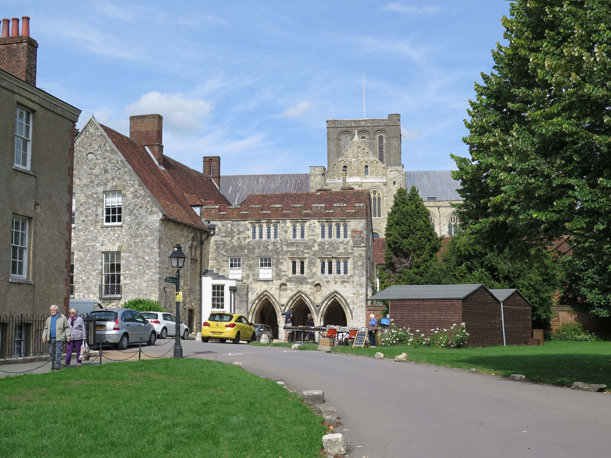
Wandering Around Winchester

Wandering Around Winchester

The good thing about Winchester is that a stroll around the city centre can be accomplished comfortably in about an hour and a half. This doesn’t include visits to the Cathedral, the Great Hall or the pub mind you, so you’ll need to allow extra time for visiting some of the things that will hold you up on the way around as well.

On the map opposite I’ve compiled a trail which covers most of the interesting things that can be seen. Some places will occupy just a few minutes of your time and others considerably longer, and just a quick reminder for anyone who may be interested, you can always print out this post by clicking on the print icon at the bottom of the page. The map can also be printed out by using the ‘print map’ feature within the map itself.

I’ve chosen to start the trail at the King Alfred Statue in the Broadway (No1 on the map), and if you’ve read my introduction to Winchester – The First Capital of England, you’ll understand why I’ve chosen it as the starting point. I’m not going to describe his achievements here as this blog is mainly about what there is to see.

Continue reading

Originally posted 2019-03-22 14:18:04.

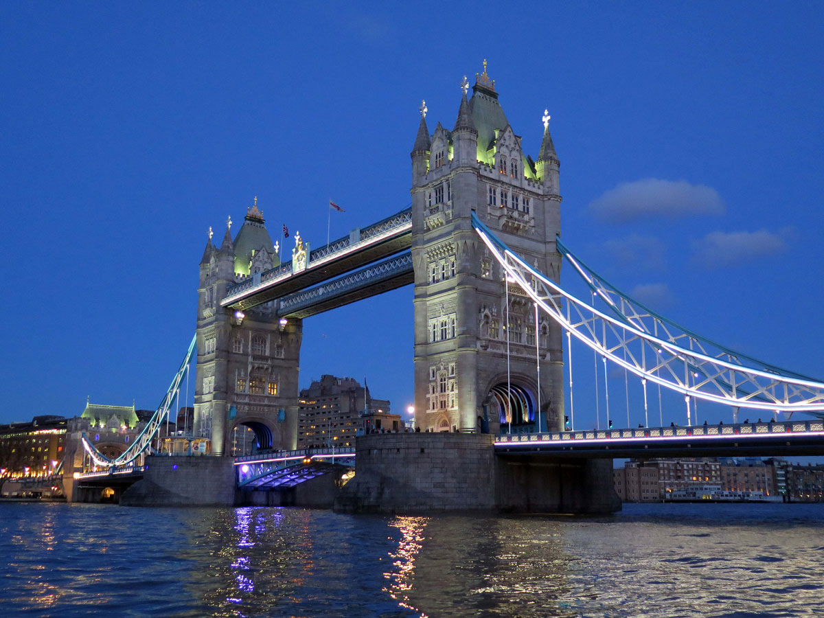
Tower Bridge

Tower Bridge

Some bridges have a great design and some are just practical, but what captures my imagination about Tower Bridge is its ability to achieve both.

40,000 people a day still use the bridge in one way or another, but ships passing underneath still have priority, and that’s around a thousand times a year: Even President Bill Clinton’s cavalcade on a state visit got split up when they didn’t time it right.

The need for another crossing downstream of London Bridge came about with the growth of London Docks.

The Industrial Revolution and the ever-expanding British Empire helped the burgeoning London Docks become the busiest in the world, and apart from providing access across the river downstream from London Bridge for the first time, the new Tower Bridge was going to have to allow shipping access in and out of the Pool of London.

Continue reading

Originally posted 2018-10-19 16:33:18.

Canary Wharf

Canary Wharf

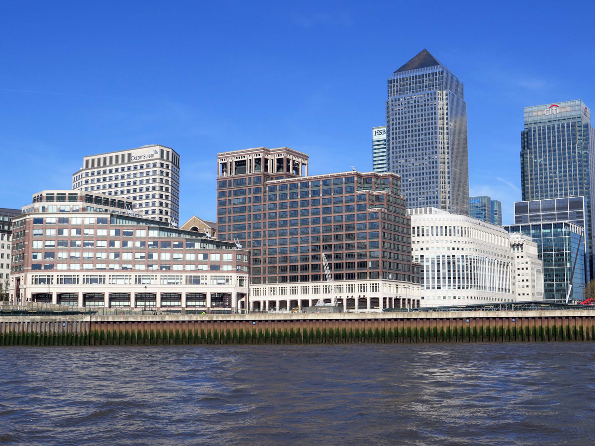
London is undeniably one of the world’s most important financial centres, and although the City of London has traditionally been at the heart of London’s finance industry, Canary Wharf has today joined it as a place to come where fortunes can be made or lost at the press of a button.

It hasn’t always been like this of course. The area referred to as Canary Wharf is located on the Isle of Dogs and includes the former West India Dock, the first dock to be built in London.

Built purely to handle trade with the West Indies, it still has the same basic layout as when it was built in the early 19th century, but the name ‘Canary Wharf’ didn’t come into existence until 1937 when a warehouse was built at North Dock to handle fruit from the Canary Islands.

In 1802 the North (import) Dock was the first part of the West India Dock scheme to be built, followed 4 years later by the Middle (export) Dock. The South Dock was completed much later and was never really intended to be part of the set-up.

Continue reading

Originally posted 2019-03-29 15:44:43.

The Borough of Camden

The Borough of Camden

The Borough of Camden takes its name from Camden Town, which lies roughly half-way between Holborn in the south and Hampstead Heath in the north.

Places of interest within its boundaries include Camden Town, parts of Covent Garden, Lincoln’s Inn Fields, the British Museum, the British Library, and Hampstead.

The southern part of the borough falls within Central London, and is where the major railway hub of Euston, King’s Cross, and St Pancras stations meet near the British Library.

When Britain’s first census was conducted in 1801 the total population for the parishes that make up today’s borough was 96,795. At its peak in 1891 it was 376,500, but demolition to build the railways, slum clearance, and the Blitz all resulted in a substantial fall in numbers to 161,100 by 1981. Since then there’s been a steady increase with the 2011 figures showing a population of 220,338.

The Borough of Camden, like many other places, has a disparity between districts like leafy Hampstead and grungy Camden Town, but on the whole, it has traditionally been a socialist part of London.

Continue reading

Originally posted 2018-08-12 08:09:16.

Bankside

Bankside

The Bankside area of Southwark roughly equates with the riverside between Blackfriars Bridge and London Bridge.

The distance between the two bridges is about a mile and there are not only plenty of things to see, but also a fair number of pubs to hold you up along the way, and if you stop at all of them you’ll need holding up yourself.

Next to Blackfriars Railway Bridge is the Founders Arms, which although modern is in a great location overlooking the river, but as this isn’t a pub crawl I’ll assume that you’ll want to move straight on to the first real point of interest which is the Tate Modern.

Housed inside the former Bankside Power Station, this gallery of modern art won’t appeal to everyone, and depending on your taste in art you can either spend the best part of a day in here or hardly any time at all. Either way, you should go in and take a look, not just because it’s free, but you can always take the lift up to the viewing level of the Blavatnik Building for great views over the City of London and beyond.

Outside the river entrance to the Tate Modern is the Millennium Bridge. No prizes for guessing where it got its name from, but you may be tempted across it because on the other side of the river is St Paul’s Cathedral, but as tempting as it may be, it’s best left for another time.

Continue reading

Originally posted 2018-03-21 08:15:44.

The Churchill War Rooms

The Churchill War Rooms


Not as conspicuous as the nearby Houses of Parliament or Westminster Abbey, Churchill’s War Rooms is a must see for anyone interested in where Britain’s top brass and politicians directed the Second World War from.

Even before the outbreak of war, it was decided that these decision makers wouldn’t abandon London and its people, and so the basement of the Office of Works building opposite St James’s Park, was adapted and strengthened to suit its new purpose.
Officially known as the ‘New Public Offices‘, but unofficially as just ‘George St’, the corridors of this subterranean nerve centre became a bunker, with a cabinet war room, private rooms for the prime minister and chiefs of staff, a map room where plans were worked out, and several other rooms that would help to facilitate the war effort.
From 27th August 1939 until the lights finally went out on 15th August 1945, a total of 115 cabinet meetings were held here.

At the end of the war the rooms were left just as they were, and in 1948 they were given the status of a historic site. In 1981, the incumbent Prime Minister, Margaret Thatcher, decreed that the public should have access to this historic site and the Imperial War Museum opened the doors to the Cabinet War Rooms in 1984. In 2005 the Churchill Museum was added.

Continue reading

Originally posted 2017-12-18 16:19:48.

The Bank of England Museum

The Bank of England Museum

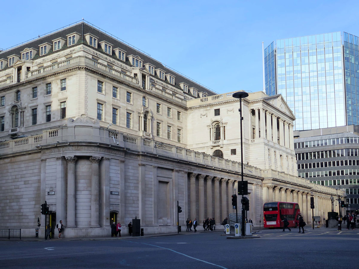
There are many powerful institutions in the City of London’s Financial District, but none more so than the Bank of England. Now before you skip this article thinking that it’s going to be another one of those boring Easymalc ramblings, I promise I won’t go on about Fiscal Policies or Quantitative Easing. For a start if I understood any of it I would be sipping a Pina Colada in the Cayman Islands or somewhere instead of struggling to see which lasts the longest – my meagre savings, or me. Anyway, back to the Bank of England.

I don’t imagine too many people know, or even care, about what the Bank of England actually does, but the museum, which is free to go in by the way, will explain its beginnings, the role it plays, and even how Quantitative Easing works (sorry, I couldn’t resist it). To be honest it’s not only educational, but interesting as well – or at least I thought so.

Continue reading

Originally posted 2018-07-02 18:41:41.

Stonehenge

Stonehenge

I don’t think I’m wrong when I say that Stonehenge is one of those places that sits high on many people’s list of life’s big disappointments, but with the right mental attitude and a bit of forward planning it can still be somewhere that you’ll be glad to say you’ve seen.

This UNESCO World Heritage Site lies about nine miles north of Salisbury and can be reached by the useful ‘Stonehenge Tour Bus’ which does a circuit between the city, Old Sarum, and Stonehenge.

(http://www.thestonehengetour.info/)

The first obvious detraction from this iconic site is its proximity to the main A303 trunk road which has been constantly debated about ever since I can remember.

Not so long ago the A360 road to Devizes and the inadequate visitor centre were also bones of contention, but were both rectified by the closure of the road and the re-positioning of a new modern visitor centre 1½ miles away.

Continue reading

Originally posted 2018-08-26 08:12:28.

Arundells

Arundells

On the West Walk of Salisbury’s Cathedral Close is the former home of British Prime Minister Sir Edward Heath.

The house is open to the public, and although its history goes back long before ‘Ted’ Heath moved here in 1985, there’s only really one reason that people come here to visit, and that’s to see where Sir Edward Heath KG MBE spent some of the happiest moments of his life.

From a fairly ordinary background, Ted managed to make himself an extraordinary life. He worked his way through university into the corridors of power and eventually to leader of the Conservative party, a post he held from 1965 until 1975.

In 1970 he became Prime Minister and for the next four years struggled to contain the demands of the trade unions, curtail The Troubles in Northern Ireland, and the aspirations of Margaret Thatcher – although he did manage to take Britain into the European Economic Community in 1973.

He probably won’t be remembered as one of Britain’s greatest Prime Ministers, but he had many attributes, and even though my politics were different to his, I always thought of him as a warm and compassionate human being. Talking to the volunteers around the house I don’t think I was alone in thinking that.

Looking back, I think that maybe his political views weren’t conservative enough for his fellow party members, and not far enough to the left to embrace the working population.

Continue reading

Originally posted 2018-07-22 16:31:14.

The Close

The Close

In my Salisbury Cathedral Pt 2 review I gave James Wyatt a bit of a rough time for his so-called improvements to the church, but I’m going to give ’Wrecker’ Wyatt a bit of credit here for a change.

Between 1789 and 1792 he embarked on his mission to improve the Cathedral and its surroundings including the churchyard which was situated in an area of swampy marshland. He removed the tombstones, drained the swamp, and created a landscape fit for a Cathedral.

It now stands in the centre of a large enclosed Green known as ‘The Close’, which is entered by one of three gates – the North Gate, St. Ann’s Gate, and Harnham Gate. Inside these gates is an oasis of peace and tranquillity no matter how many people come to visit the Cathedral. This is the largest Close in England with plenty of room for everyone and the buildings surrounding it are an absolute architectural delight. They’ve evolved over the centuries into a harmonious composition of different styles.

Continue reading

Originally posted 2018-04-01 06:08:31.

The Floating Harbour

The Floating Harbour

Bristol’s Floating Harbour doesn’t float, so why is it called that? It takes a bit of explaining, but to understand what the Floating Harbour is will help to explain why Bristol’s maritime history was so important to the city for so long.

The port developed approximately 8 miles from the mouth of the River Avon during the 11th century, which at the time would have had the distinct advantage of being in a very sheltered location. Not only that, the River Severn has one of the highest tidal ranges in the world, which meant that the fast-flowing tide could bring ships swiftly up the Severn and the Avon to the protection of Bristol’s inland harbour.

For centuries it worked well, but as the ships got bigger things became a bit more complicated. Anyone who has witnessed the ebb and flow of these rivers will know only too well how quickly the tide can go out as well as come in, and the bigger the ships became, the more often they got stuck in the mud – and there’s plenty of that here.

Continue reading

Originally posted 2019-01-17 07:49:03.

Porthcurno

Porthcurno

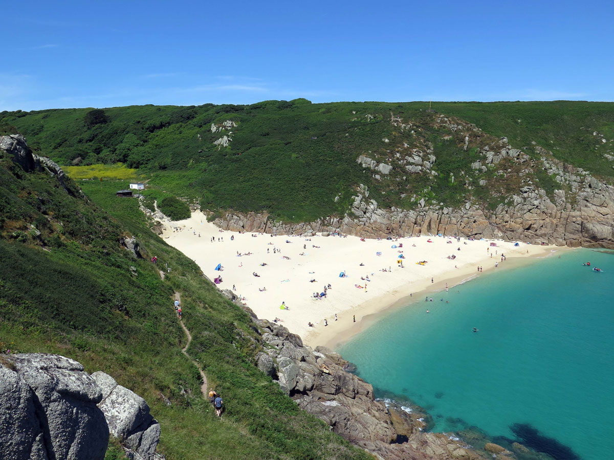
Porthcurno lies in a valley that reaches down to the sea on the south coast of the Penwith Peninsula.

For such a small village it attracts many visitors, some would say too many at times, but it’s understandable why people find Porthcurno such a magnet.

Lying about half way between Lamorna Cove and Land’s End, Porthcurno would be an obvious stopping off point for people walking along this section of the South-West Coast Path without its own attractions.

The white shell beach sits in a small bay that is sometimes called Porthcurno Bay. The colour of the sea depends on the weather, state of the tide and the time of the day, but when the sun’s shining the white sand is reflected by the sun to make the sea a perfect aquamarine colour.

The bay is protected to the east by a headland that is renowned for its ‘Logan Rock’ and to the west by Pedn-men-an-mere, or Wireless Point as it’s sometimes called.

It gets its name of Wireless Point from the receiving station that was set up here to eavesdrop on Marconi’s successful wireless telegraphy operation which was in direct competition with Porthcurno’s underground and submarine cable communications.

Continue reading

Originally posted 2018-09-23 05:12:07.

Falmouth Harbour

Falmouth Harbour

I don’t know how many hours I’ve wasted trawling through facts and figures about the smallest this and the largest that, and now here’s another one. Some people claim that Falmouth is the third largest deep water natural harbour in the world. There are so many variables about what constitutes the criteria for that claim, that I’ve given up trying to get to the bottom of it (the claim I mean, not the harbour).

There’s a difference between a harbour and a bay for instance, and I think it’s fair to say that Sydney Harbour is the most likely candidate for being the largest. The other contenders will have to fight it out because it’s not clear cut. Falmouth however, does qualify as being a natural harbour because it’s really a tidal drowned river valley, or ria, to give it the proper name – and it is deep.

Several rivers merge to provide fresh water for the harbour and they all end up in Carrick Roads, the main body of water in Falmouth Harbour. Its unusual name comes from the Karrek Ruen (Black Rock) which is a potential hazard at the mouth of the estuary between St. Anthony Head and Pendennis Point.

Continue reading

Originally posted 2020-08-11 21:47:50.

Charlestown

Charlestown

Situated in St. Austell Bay, just 2 miles south-east of St. Austell’s town centre, Charlestown boasts a harbour with a fleet of Tall Ships that can easily transport the receptive mind back to times gone by – and to complete the image of pirates and treasure it also has a Shipwreck and Heritage Centre.

West Polmeor, as it was originally called, was just a small fishing village until a harbour was constructed to fulfil the needs of the local mineral mines and clay pits.

A local businessman by the name of Charles Rashleigh was the man responsible for building the harbour, and in 1799 the village was re-named ‘Charles’ Town’ after him.

Continue reading

Originally posted 2019-02-06 18:02:35.

Wheal Martyn China Clay Museum and Country Park

Wheal Martyn China Clay Museum and Country Park

Until the opening of the Eden Project in 2001, the only holidaymakers that would have been seen wandering around the St. Austell countryside were those that were lost.

The industrial landscape above the town wasn’t one of the things that most visitors to Cornwall had come to see, but anybody who decides to make their way to Wheal Martyn will be rewarded with a fascinating insight into how important the industry has been to the region.

This open-air museum, heritage centre, or whatever it wants to call itself now, incorporates all aspects of china clay from the days when William Cookworthy, a Plymouth apothecary, discovered kaolin at Tregonning Hill near Germoe in West Cornwall in 1746.

He wasn’t the first to find it of course – it had been used in China for thousands of years, but the desire for an equivalent ingredient to manufacture high quality porcelain in England had eluded the aristocracy for ages.

Continue reading

Originally posted 2018-03-24 16:58:10.

Picturesque Polperro

Picturesque Polperro

If someone unfamiliar with Cornwall were to ask me to take them to a picturesque Cornish fishing village, I would have to take them to Polperro. It has everything you would expect – from a lovely harbour, narrow streets with quaint cottages, coastal walks and some great pubs to finish off with; what more could you ask for?

The only problem is that I’m not the only one who thinks it has everything, and so if you choose to come at the same time as everyone else then Polperro might not live up to expectations. I know this applies to any popular destination, but if you can come on a pleasant day out of season (preferably with an overnight stop) then you will be rewarded with a much better experience.

You can reach Polperro from Looe by a bus service that suits the company more than it does the passengers (remember everything down here operates on Cornish Mean Time), but if you have your own transport you will have to park at the top of the village near the Crumplehorn Inn where the local highwayman used to masquerade as the car park attendant. These days he’s been replaced by his metal mickey equivalent whose advanced technology doesn’t seem to stretch as far as being able to dish out any change.

Continue reading

Originally posted 2019-04-02 06:10:30.